Wincheap
| Wincheap | |
|---|---|
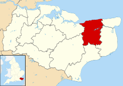
 Wincheap Wincheap shown within Kent | |
| Population | 9,095 (Ward 2011)[1] |
| District | |
| Shire county | |
| Region | |
| Country | England |
| Sovereign state | United Kingdom |
| Post town | Canterbury |
| Postcode district | CT1 |
| Police | Kent |
| Fire | Kent |
| Ambulance | South East Coast |
| EU Parliament | South East England |
Wincheap is a road that gives its name to a southwest suburb of Canterbury in Kent, England. It forms part of the A28 road, stretching for nearly a mile from the city wall, close by Canterbury East railway station, to the over-crossing of the A2 and the parish of Thanington Without.
History
Wincheap was established by the early 13th century. There are two theories about the name, either it comes from the Saxon Wenchiape, a wine market, or from Weychep from the old English Waegnceap, a wagon, which might have been parked outside the city walls.
References
- ↑ "Canterbury Ward population 2011". Neighbourhood Statistics. Office for National Statistics. Retrieved 11 September 2016.
This article is issued from
Wikipedia.
The text is licensed under Creative Commons - Attribution - Sharealike.
Additional terms may apply for the media files.