Upper Harbledown
| Upper Harbledown | |
|---|---|
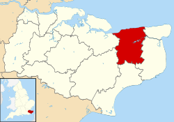
 Upper Harbledown Upper Harbledown shown within Kent | |
| OS grid reference | TR114584 |
| District | |
| Shire county | |
| Region | |
| Country | England |
| Sovereign state | United Kingdom |
| Post town | Canterbury |
| Postcode district | CT2 |
| Dialling code | 01227 |
| Police | Kent |
| Fire | Kent |
| Ambulance | South East Coast |
| EU Parliament | South East England |
| UK Parliament | |
Upper Harbledown is a village in Harbledown and Rough Common civil parish about 2 miles (3 km) west of Canterbury, Kent, England. The population is roughly 400.
History
The village lies on[1] or very close to the ancient trackway known as Watling Street. This became the main A2 road from London to Canterbury and Dover, which ran through the centre of the village before it was bypassed.
Amenities
The village has a village green, a children's play area, and a village hall. It did have a public house, The Plough, and a garden centre, but these have both closed down.
References
- ↑ Codrington, T., Roman roads in Britain, SPCK, 1903
External links
![]()
This article is issued from
Wikipedia.
The text is licensed under Creative Commons - Attribution - Sharealike.
Additional terms may apply for the media files.