Wilgartswiesen
| Wilgartswiesen | ||
|---|---|---|
| ||
 Wilgartswiesen Location of Wilgartswiesen within Südwestpfalz district 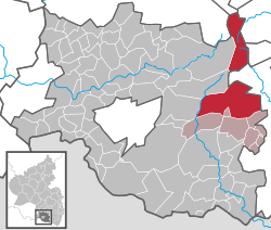 | ||
| Coordinates: 49°13′N 7°53′E / 49.217°N 7.883°ECoordinates: 49°13′N 7°53′E / 49.217°N 7.883°E | ||
| Country | Germany | |
| State | Rhineland-Palatinate | |
| District | Südwestpfalz | |
| Municipal assoc. | Hauenstein | |
| Government | ||
| • Mayor | Robert Brödel | |
| Area | ||
| • Total | 58.34 km2 (22.53 sq mi) | |
| Elevation | 220 m (720 ft) | |
| Population (2017-12-31)[1] | ||
| • Total | 1,009 | |
| • Density | 17/km2 (45/sq mi) | |
| Time zone | CET/CEST (UTC+1/+2) | |
| Postal codes | 76848 | |
| Dialling codes | 06392 | |
| Vehicle registration | PS | |
| Website | www.wilgartswiesen.de | |

Wilgartswiesen is a municipality in Südwestpfalz district, in Rhineland-Palatinate, western Germany.
Geography
The municipality lies in the southern part of the Palatine Forest, the German part of the Wasgau, in the middle of the Palatine Forest-North Vosges Biosphere Reserve. On the territory of Wilgartswieser the Wellbach stream empties into the Queich, which itself is one of the main drainage systems of the Palatinate region. North of the village run several bunter sandstone rock groups, out of which the castles of Wilgartaburg and Falkenburg have been hewn. The municipal terrain, most of which is part of the Frankenweide, is almost entirely wooded.
References
- ↑ Statistisches Landesamt Rheinland-Pfalz "Bevölkerungsstand 2017 - Gemeindeebene" Check
|url=value (help). Statistisches Landesamt Rheinland-Pfalz (in German). 2018.
This article is issued from
Wikipedia.
The text is licensed under Creative Commons - Attribution - Sharealike.
Additional terms may apply for the media files.