Thaleischweiler-Fröschen
| Thaleischweiler-Fröschen | ||
|---|---|---|
| ||
 Thaleischweiler-Fröschen Location of Thaleischweiler-Fröschen within Südwestpfalz district 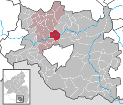 | ||
| Coordinates: 49°15′48″N 7°34′59″E / 49.26333°N 7.58306°ECoordinates: 49°15′48″N 7°34′59″E / 49.26333°N 7.58306°E | ||
| Country | Germany | |
| State | Rhineland-Palatinate | |
| District | Südwestpfalz | |
| Municipal assoc. | Thaleischweiler-Wallhalben | |
| Government | ||
| • Mayor | Thomas Peifer (CDU) | |
| Area | ||
| • Total | 12.27 km2 (4.74 sq mi) | |
| Elevation | 299 m (981 ft) | |
| Population (2017-12-31)[1] | ||
| • Total | 3,317 | |
| • Density | 270/km2 (700/sq mi) | |
| Time zone | CET/CEST (UTC+1/+2) | |
| Postal codes | 66987 | |
| Dialling codes | 06334 | |
| Vehicle registration | PS | |
| Website | www.vg-thaleischweiler-froeschen.de | |

Thaleischweiler-Fröschen is a municipality in the Südwestpfalz district, in Rhineland-Palatinate, Germany. It is situated on the western edge of the Palatinate forest, approx. 7 km north of Pirmasens.
Thaleischweiler-Fröschen is the seat of the Verbandsgemeinde ("collective municipality") Thaleischweiler-Wallhalben.
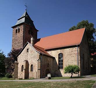
Protestant church
References
- ↑ Statistisches Landesamt Rheinland-Pfalz "Bevölkerungsstand 2017 - Gemeindeebene" Check
|url=value (help). Statistisches Landesamt Rheinland-Pfalz (in German). 2018.
This article is issued from
Wikipedia.
The text is licensed under Creative Commons - Attribution - Sharealike.
Additional terms may apply for the media files.