Wildenbörten
| Wildenbörten | |
|---|---|
 Wildenbörten Location of Wildenbörten within Altenburger Land district 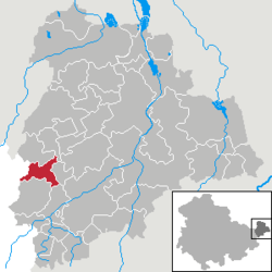 | |
| Coordinates: 50°54′45″N 12°17′11″E / 50.91250°N 12.28639°ECoordinates: 50°54′45″N 12°17′11″E / 50.91250°N 12.28639°E | |
| Country | Germany |
| State | Thuringia |
| District | Altenburger Land |
| Municipal assoc. | Oberes Sprottental |
| Government | |
| • Mayor | Gerhard Fischer |
| Area | |
| • Total | 7.81 km2 (3.02 sq mi) |
| Elevation | 240-295 m (−728 ft) |
| Population (2017-12-31)[1] | |
| • Total | 258 |
| • Density | 33/km2 (86/sq mi) |
| Time zone | CET/CEST (UTC+1/+2) |
| Postal codes | 04626 |
| Dialling codes | 034491 |
| Vehicle registration | ABG |
| Website | www.wildenboerten.de |
Wildenbörten is a German municipality in the Thuringian district of Altenburger Land. It belongs to the Verwaltungsgemeinschaft of Oberes Sprottental.
Geography
Neighboring municipalities
Municipalities near Wildenbörten are Drogen, Löbichau, Lumpzig, Mehna, and Nöbdenitz in the district of Altenburger Land; as well as Großenstein and Reichstädt in the district of Greiz.
Municipal organization
The municipality of Wildenbörten consists of five subdivisions: Wildenbörten, Dobra, Graicha, Hartroda, and Kakau.
History
Within the German Empire (1871–1918), Wildenbörten was part of the Duchy of Saxe-Altenburg.
References
This article is issued from
Wikipedia.
The text is licensed under Creative Commons - Attribution - Sharealike.
Additional terms may apply for the media files.