Thonhausen
| Thonhausen | |
|---|---|
 Thonhausen Location of Thonhausen within Altenburger Land district 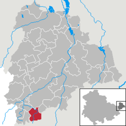 | |
| Coordinates: 50°50′0″N 12°19′32″E / 50.83333°N 12.32556°ECoordinates: 50°50′0″N 12°19′32″E / 50.83333°N 12.32556°E | |
| Country | Germany |
| State | Thuringia |
| District | Altenburger Land |
| Municipal assoc. | Oberes Sprottental |
| Government | |
| • Mayor | André Hupfer |
| Area | |
| • Total | 9.40 km2 (3.63 sq mi) |
| Elevation | 300 m (1,000 ft) |
| Population (2017-12-31)[1] | |
| • Total | 546 |
| • Density | 58/km2 (150/sq mi) |
| Time zone | CET/CEST (UTC+1/+2) |
| Postal codes | 04626 |
| Dialling codes | 034496 |
| Vehicle registration | ABG |
| Website | www.thonhausen.de |
Thonhausen is a German municipality in the Thuringian district of Altenburger Land. It belongs to the Verwaltungsgemeinschaft of Oberes Sprottental.
Geography
Neighboring municipalities
Communities near Thonhausen are Jonaswalde, Heyersdorf, the City of Schmölln, and Vollmershain in the Landkreis Altenburger Land; as well as the City of Crimmitschau in the Saxon Landkreis of Zwickauer Land.
Municipal arrangement
Thonhausen has three districts: Thonhausen, Schönhaide, and Wettelswalde.
Business and Infrastructure
Thonhausen is located at the Schmölln Interchange on Bundesautobahn 4.
References
- The information in this article is based on and/or translated from its German equivalent.
This article is issued from
Wikipedia.
The text is licensed under Creative Commons - Attribution - Sharealike.
Additional terms may apply for the media files.