Vollmershain
| Vollmershain | |
|---|---|
 Vollmershain Location of Vollmershain within Altenburger Land district 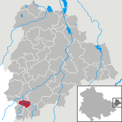 | |
| Coordinates: 50°51′19″N 12°17′18″E / 50.85528°N 12.28833°ECoordinates: 50°51′19″N 12°17′18″E / 50.85528°N 12.28833°E | |
| Country | Germany |
| State | Thuringia |
| District | Altenburger Land |
| Municipal assoc. | Oberes Sprottental |
| Government | |
| • Mayor | Gerd Junghanns (CDU) |
| Area | |
| • Total | 5.00 km2 (1.93 sq mi) |
| Elevation | 250 m (820 ft) |
| Population (2017-12-31)[1] | |
| • Total | 318 |
| • Density | 64/km2 (160/sq mi) |
| Time zone | CET/CEST (UTC+1/+2) |
| Postal codes | 04626 |
| Dialling codes | 034496 |
| Vehicle registration | ABG |
| Website | www.vollmershain.de |
Vollmershain is a town in the Verwaltungsgemeinschaft of Oberes Sprottental in the Thuringian landkreis of Altenburger Land in Germany.
Geography
The town's site
The village of Vollmershain is located along 4 km of the Sprotte. The highest part of the community is 306.2 m high on the side of the Mühlberg (308.1 m).
Neighbouring communities
Other municipalities near Vollmershain are Heukewalde, Jonaswalde, Posterstein, Nöbdenitz, Thonhausen, and the Weißbach district of Schmölln in the Landkreis of Altenburger Land.
History
- The village was first mentioned in writing in 1181 in a tithe register of the Posau Cloister in Zeitz.
- During the Thirty Years' War, the Swedish General Wrangel had his headquarters in the area around Vollmershain in 1646.
- Within the German Empire (1871–1918), Vollmershein was part of the Duchy of Saxe-Altenburg.
References
- The information in this article is based on and/or translated from that in its German equivalent.
This article is issued from
Wikipedia.
The text is licensed under Creative Commons - Attribution - Sharealike.
Additional terms may apply for the media files.