Heyersdorf
| Heyersdorf | |
|---|---|
 Heyersdorf Location of Heyersdorf within Altenburger Land district 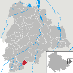 | |
| Coordinates: 50°50′0″N 12°20′0″E / 50.83333°N 12.33333°ECoordinates: 50°50′0″N 12°20′0″E / 50.83333°N 12.33333°E | |
| Country | Germany |
| State | Thuringia |
| District | Altenburger Land |
| Government | |
| • Mayor | Helga Leitholdt |
| Area | |
| • Total | 3.78 km2 (1.46 sq mi) |
| Elevation | 290 m (950 ft) |
| Population (2017-12-31)[1] | |
| • Total | 123 |
| • Density | 33/km2 (84/sq mi) |
| Time zone | CET/CEST (UTC+1/+2) |
| Postal codes | 04626 |
| Dialling codes | 03762 |
| Vehicle registration | ABG |
Heyersdorf is a municipality in the Thuringian district of Altenburger Land.
Geography
Heyersdorf is located near the municipalities of Ponitz, the city of Schmölln, and Thonhausen in the district of Altenburger Land; as well as near the city of Crimmitschau in the Saxon district of Zwickauer Land.
History
Until 1920, Heyersdorf was part of the Kingdom of Saxony.
Politics
Together with Ponitz, Heyersdorf is the assigning municipality for Gößnitz.
Business and Infrastructure
Heyersdorf is located on Bundesautobahn 4.
Twin towns
Heyersdorf is twinned with:


References
| Authority control |
|---|
This article is issued from
Wikipedia.
The text is licensed under Creative Commons - Attribution - Sharealike.
Additional terms may apply for the media files.