West Bradford, Lancashire
| West Bradford | |
|---|---|
 Eaves Hall | |
 West Bradford Location in Ribble Valley Borough 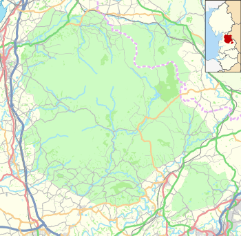 West Bradford Location in the Forest of Bowland  West Bradford West Bradford shown within Lancashire | |
| Population | 788 (Parish 2011)[1] |
| OS grid reference | SD745445 |
| Civil parish |
|
| District | |
| Shire county | |
| Region | |
| Country | England |
| Sovereign state | United Kingdom |
| Post town | CLITHEROE |
| Postcode district | BB7 |
| Dialling code | 01200 |
| Police | Lancashire |
| Fire | Lancashire |
| Ambulance | North West |
| EU Parliament | North West England |
| UK Parliament | |
West Bradford is a village and civil parish Lancashire, England, 27 miles (43 km) west of the larger city of Bradford, West Yorkshire and 2.5 miles (4 km) north of Clitheroe. The population of the civil parish taken at the 2011 census was 788.[1] It covers some 2000 acres of the Forest of Bowland. In Domesday, it is recorded as Bradeford and in the thirteenth century, Braford in Bouland. It was part of the West Riding of Yorkshire until 1974. "West Bradford" was introduced in the nineteenth century at the time of the introduction of postal services to help distinguish the village from its larger eastern neighbour of the same name.[2]
Along with Waddington, Grindleton and Sawley the parish forms the Waddington and West Bradford ward of Ribble Valley Borough Council. [3][4]
History
Since the fourteenth century, West Bradford has formed part of the Liberty of Slaidburn. In turn, Slaidburn was part of the ancient Lordship of Bowland which comprised a Royal Forest and a Liberty of ten manors spanning eight townships and four parishes and covered an area of almost 300 square miles (800 km2) on the historic borders of Lancashire and Yorkshire.[5] The manors within the Liberty were Slaidburn (Newton-in-Bowland, West Bradford, Grindleton), Knowlmere, Waddington, Easington, Bashall Eaves, Mitton, Withgill (Crook), Leagram (Bowland-with-Leagram), Hammerton and Dunnow (Battersby).[6]
Mahatma Gandhi stayed here (Heys Farm Guest House) in 1931 when he came to visit the cotton mills of Lancashire.[7]
Media gallery
 3 Millstones Inn
 St Catherine's Church
 Waddington & West Bradford Primary School
 West Bradford Methodist Church
 West Bradford Brook
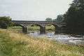 Horrocksford Bridge over the Ribble
See also
References
- 1 2 UK Census (2011). "Local Area Report – West Bradford Parish (1170215136)". Nomis. Office for National Statistics. Retrieved 24 February 2018.
- ↑ Ekwall, Eilert, The Concise Oxford Dictionary of English Place-Names. Oxford, Oxford University Press, 4th edition, 1960. p. 58. ISBN 0198691033.
- ↑ "Waddington and West Bradford". MARIO. Lancashire County Council. Retrieved 25 March 2016.
- ↑ "Waddington and West Bradford". Ordnance Survey Linked Data Platform. Ordnance Survey. Retrieved 25 March 2016.
- ↑ "Lord of the Fells, Guardian of History" (PDF). Rural Life. November 2014.
- ↑ Forest of Bowland official website
- ↑ Duckworth, Alan. "Gandhi: a visit to Lancashire". Cotton Town: Blackburn with Darwen. Archived from the original on 28 September 2007. Retrieved 31 May 2009.
External links
| Wikimedia Commons has media related to West Bradford, Lancashire. |
- The ancient parish of Great Mitton: historical and genealogical information at GENUKI (West Bradford was in this parish).