West, Abbot's and Lound Woods
| Site of Special Scientific Interest | |
 | |
| Area of Search | Cambridgeshire |
|---|---|
| Grid reference | TF 059 010 [1] |
| Interest | Biological |
| Area | 50.4 hectares[1] |
| Notification | 1987[1] |
| Location map | Magic Map |
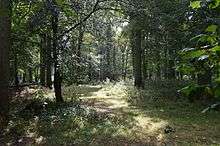
West, Abbot's and Lound Woods is a 50.4 hectare biological Site of Special Scientific Interest south of Wittering in Cambridgeshire.[1][2]
The site has a variety of woodland types, some of which are rare in Britain, including plateau alderwood. There are ancient woodland plants such as yellow archangel and toothwort.[3]
The site is private land with no public access.
References
- 1 2 3 4 "Designated Sites View: West, Abbot's and Lound Woods". Natural England. Retrieved 28 August 2016.
- ↑ "Map of West, Abbot's and Lound Woods". Sites of Special Scientific Interest. Natural England. Retrieved 28 August 2016.
- ↑ "West, Abbot's and Lound Woods citation" (PDF). Sites of Special Scientific Interest. Natural England. Retrieved 28 August 2016.
| Wikimedia Commons has media related to West, Abbot's and Lound Woods. |
This article is issued from
Wikipedia.
The text is licensed under Creative Commons - Attribution - Sharealike.
Additional terms may apply for the media files.