Waynesboro, Pennsylvania
| Waynesboro, Pennsylvania | |
|---|---|
| Borough | |
 | |
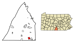 Location of Waynesboro in Franklin County, Pennsylvania. | |
 Location of Waynesboro in Franklin County, Pennsylvania. | |
| Coordinates: 39°45′13″N 77°34′55″W / 39.75361°N 77.58194°WCoordinates: 39°45′13″N 77°34′55″W / 39.75361°N 77.58194°W | |
| Country | United States |
| State | Pennsylvania |
| County | Franklin |
| Settled | 1749 |
| Government | |
| • Type | Borough Council |
| • Mayor | Richard Starliper |
| Area[1] | |
| • Total | 3.41 sq mi (8.84 km2) |
| • Land | 3.41 sq mi (8.84 km2) |
| • Water | 0.00 sq mi (0.00 km2) |
| Elevation | 718 ft (219 m) |
| Population (2010) | |
| • Total | 10,568 |
| • Estimate (2016)[2] | 10,845 |
| • Density | 3,178.49/sq mi (1,227.14/km2) |
| Time zone | UTC-5 (Eastern (EST)) |
| • Summer (DST) | UTC-4 (EDT) |
| ZIP code | 17268 |
| Area code(s) | 717, 223 |
| FIPS code | 42-81824 |
| Website | Waynesboro |
Waynesboro is a borough in Franklin County, Pennsylvania, on the southern border of the state. Waynesboro is in the Cumberland Valley between Hagerstown, Maryland, and Chambersburg, Pennsylvania. It is part of Chambersburg, PA Micropolitan Statistical Area, which is part of the Baltimore–Washington metropolitan area. It is 2 miles north of the Mason–Dixon line and close to Camp David and the Raven Rock Mountain Complex.
The population within the borough limits was 10,568 at the 2010 census. When combined with the surrounding Washington and Quincy Townships, the population of greater Waynesboro is 28,285. The Waynesboro Area School District serves a resident population of 32,386, according to 2010 federal census data.
History

The region around Antietam Creek had been home to Native Americans for thousands of years prior to settlement by Anglo-Europeans in the mid-18th century. Beginning in 1751 a certain John Wallace obtained several warrants for the land on which the center of the town now stands. In 1797 John Wallace, a son of the original British settler, laid out the town of Waynesburg in what was then the state of Pennsylvania in the United States. When incorporated in 1831, the borough was given the name "Waynesboro'." It is one of several dozen towns, cities, and counties named after General Anthony Wayne, a hero of the American Revolutionary War.
During the American Civil War, Waynesboro played a part in the Gettysburg Campaign in June and July 1863. In the week before the Battle of Gettysburg, Confederate Major General Jubal Early's division of Lieutenant General Richard S. Ewell's corps of the Army of Northern Virginia passed through the community on its way northward. After the battle, General Robert E. Lee rode through the border community with his retreating forces. In 1963, a book, Fifteen Days under the Confederate Flag, told of their two-week occupation. Waynesboro During the Civil War (2011) recounts the experiences of Waynesboro's residents during the war.
Numerous stone grain mills are in the area: Welty's Mill, Shank's Mill, Hopewell Roller Mill and others. Most of them still standing and in use.
By the early years of the 20th century, Waynesboro had become a very industrial town. It was known for the manufacture of engines, boilers, grinders, threshers, boring machines, bolt cutters, wood and iron workers' vises, nut facers, etc. There were also foundries and machine shops and manufacturers of lumber products. Some local companies included Frick Company, Geiser Manufacturing, Waynesboro Knitting Mill, Connie's Sportwear, Freeman's Shoes, Landis Machine Company, and Landis Tool Company. In 1900, 5,396 people lived in the town; in 1910, 7,199 people; and in 1940 10,231 (notably more than in the year 2000 census).
With industrial restructuring, companies were being bought by larger foreign or domestic companies who didn't have the local employees interests in mind, costing the town many jobs, the town population declined through the 1960s and people were drawn to larger cities for work. From 2000 to 2010, there was an increase in population due to people having second homes, retiring in the area and an influx of people looking for more economical housing from the cities. This they could do because the borough is roughly an hour drive from Washington, DC, Baltimore, Maryland and Harrisburg, Pennsylvania and their associated airports.
Amenities
Waynesboro is home to Renfrew Museum and Park,[3] an historical museum depicting 18th-century farm life. It is named after two young sisters who reputedly died there in 1764 during a Native American attack.
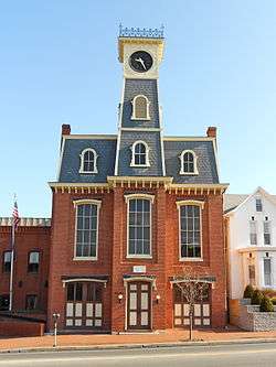
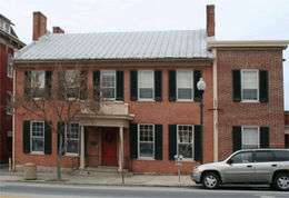
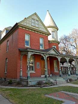
The Alexander Hamilton House, Borough Hall of the Borough of Waynesboro, Joseph J. Oller House, Royer-Nicodemus House and Farm, and Welty's Mill Bridge are listed on the National Register of Historic Places.[4]
Geography
Waynesboro is located at 39°45'13" North, 77°34'55" West (39.753685, -77.581980).[5]
According to the United States Census Bureau, the borough has a total area of 3.4 square miles (8.8 km2). 3.4 square miles (8.8 km2) of it is land and none of the area is covered with water.
Demographics
| Historical population | |||
|---|---|---|---|
| Census | Pop. | %± | |
| 1840 | 799 | — | |
| 1850 | 1,019 | 27.5% | |
| 1860 | 1,233 | 21.0% | |
| 1870 | 1,345 | 9.1% | |
| 1880 | 1,888 | 40.4% | |
| 1890 | 3,811 | 101.9% | |
| 1900 | 5,396 | 41.6% | |
| 1910 | 7,199 | 33.4% | |
| 1920 | 9,720 | 35.0% | |
| 1930 | 10,167 | 4.6% | |
| 1940 | 10,231 | 0.6% | |
| 1950 | 10,334 | 1.0% | |
| 1960 | 10,427 | 0.9% | |
| 1970 | 10,011 | −4.0% | |
| 1980 | 9,726 | −2.8% | |
| 1990 | 9,578 | −1.5% | |
| 2000 | 9,614 | 0.4% | |
| 2010 | 10,568 | 9.9% | |
| Est. 2016 | 10,845 | [2] | 2.6% |
| Sources:[6][7][8][9] | |||
As of the census[8] of 2010, there were 10,568 people, 4,512 households, and 2,740 families residing in the borough. The population density was 3,108.2 people per square mile (1,200.09/km²). There were 4,969 housing units at an average density of 1461.4 per square mile (564.2/km²). The racial makeup of the borough was 90.6% White, 2.9% African American, 0.3% Native American, 0.6% Asian, 0.0% Pacific Islander, 0.1% from other races, and 1.9% from two or more races. Hispanic or Latino of any race were 3.7% of the population.
There were 4,512 households, out of which 27.4% had children under the age of 18 living with them, 40.7% were married couples living together, 14.1% had a female householder with no husband present, and 39.3% were non-families. 32.7% of all households were made up of individuals, and 12.7% had someone living alone who was 65 years of age or older. The average household size was 2.33 and the average family size was 2.91.
In the borough, the population was spread out, with 23.4% under the age of 18, 9.8% from 18 to 24, 27.7% from 25 to 44, 24.2% from 45 to 64, and 15.1% who were 65 years of age or older. The median age was 36.6 years. For every 100 females there were 91.8 males. For every 100 females age 18 and over, there were 88.8 males.
The median income for a household in the borough was $41,155, and the median income for a family was $48,379. Males had a median income of $35,754 versus $30,872 for females. The per capita income for the borough was $21,749. About 7.0% of families and 10.3% of the population were below the poverty line, including 13.2% of those under age 18 and 8.4% of those age 65 or over.
Notable residents
- Fred Bear, March 5, 1902 – April 27, 1988) was an American bow hunter, bow manufacturer, author, and television host
- Max Bishop (September 5, 1899 – February 24, 1962) was a second baseman in Major League Baseball who played from 1924 through 1935 for the Philadelphia Athletics
- John Bonamego, football head coach at Central Michigan University; longtime NFL assistant coach
- Benjamin Claibourne Wolfe (March 14,1980) Was a goalkeeper for Waynesboro High School Soccer team. Played semi-pro soccer for Newton Storm in Newton,NC
- John Goucher, (June 7 – July 19, 1922) a Methodist pastor and the namesake of Goucher College in Towson, Maryland, was born and raised in Waynesboro[10]
- Matt White (minor league pitcher) (August 13,1978) Was a pitcher for Waynesboro High School baseball team. Played for the Tampa Bay Devil Rays in their minor league system
- Denny Fortney (12/27/1974) Played football for Waynesboro High School. Played football in th Canadian Football League for the Winnipeg Blue Bombers for 2001-2004. Was All-CFL in 2002
See also
- Bloom Brothers Department Stores
- Anthony Wayne, Revolutionary War general
- Geiser Manufacturing, a leading Waynesboro manufacturer in its heyday
Notes
- ↑ "2016 U.S. Gazetteer Files". United States Census Bureau. Retrieved Aug 13, 2017.
- 1 2 "Population and Housing Unit Estimates". Retrieved June 9, 2017.
- ↑ , Renfrew Museum official website
- ↑ National Park Service (2010-07-09). "National Register Information System". National Register of Historic Places. National Park Service.
- ↑ "US Gazetteer files: 2010, 2000, and 1990". United States Census Bureau. 2011-02-12. Retrieved 2011-04-23.
- ↑ "Number of Inhabitants: Pennsylvania" (PDF). 18th Census of the United States. U.S. Census Bureau. Retrieved 22 November 2013.
- ↑ "Pennsylvania: Population and Housing Unit Counts" (PDF). U.S. Census Bureau. Retrieved 22 November 2013.
- 1 2 "American FactFinder". United States Census Bureau. Retrieved 2008-01-31.
- ↑ "Incorporated Places and Minor Civil Divisions Datasets: Subcounty Population Estimates: April 1, 2010 to July 1, 2012". U.S. Census Bureau. Retrieved 25 November 2013.
- ↑ "John Franklin Goucher - Biography". deila.dickinson.edu. Retrieved 2018-08-08.
References
- Nead, Benjamin Matthias (1900). Waynesboro: the history of a settlement. Harrisburg Pub. Co.
External links
| Wikimedia Commons has media related to Waynesboro, Pennsylvania. |
- Greater Waynesboro Chamber of Commerce
- Mainstreet Waynesboro, Inc.
- Waynesboro Historical Society
- Borough of Waynesboro
- Waynesboro, Pennsylvania at Curlie (based on DMOZ)
- Waynesboro Area School District
- Antietam Historical Association
Municipalities and communities of Franklin County, Pennsylvania, United States | ||
|---|---|---|
| Boroughs | 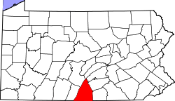 | |
| Townships | ||
| CDPs | ||
| Unincorporated communities |
| |
| Footnotes | ‡This populated place also has portions in an adjacent county or counties | |