Pleasant Hall, Pennsylvania
| Pleasant Hall, Pennsylvania | |
|---|---|
| Unincorporated community | |
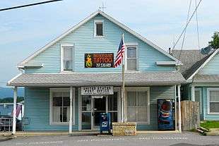 Post office | |
 Pleasant Hall  Pleasant Hall | |
| Coordinates: 40°3′11″N 77°39′14″W / 40.05306°N 77.65389°WCoordinates: 40°3′11″N 77°39′14″W / 40.05306°N 77.65389°W | |
| Country | United States |
| State | Pennsylvania |
| County | Franklin |
| Township | Letterkenny |
| Elevation | 705 ft (215 m) |
| Time zone | UTC-5 (Eastern (EST)) |
| • Summer (DST) | UTC-4 (EDT) |
| ZIP code | 17246 |
| Area code(s) | 717 |
| GNIS feature ID | 1184018[1] |
Pleasant Hall is an unincorporated community in Letterkenny Township in Franklin County, Pennsylvania, United States. Pleasant Hall is located at the intersection of Pennsylvania Route 533 and Pennsylvania Route 997 north of Chambersburg and northeast of the Letterkenny Army Depot.[2]
The Pleasant Hill ZIP code 17246 covers 1.63 sq mi (4.2 km2) and a population of 195.[3][4]
Pleasant Hall was platted about 1840.[5] A post office called Pleasant Hall has been in operation since 1851.[6]
References
- ↑ "Pleasant Hall". Geographic Names Information System. United States Geological Survey.
- ↑ Franklin County, Pennsylvania Highway Map (PDF) (Map). PennDOT. 2015. Retrieved January 2, 2016.
- ↑ "American Fact Finder, 17246". U.S. Census Bureau. Retrieved August 3, 2016.
- ↑ "17246". United States Zip Codes. Retrieved August 3, 2016. Note that this is not an official USPS website, but it includes a map.
- ↑ M'Cauley, I. H. (1878). Historical Sketch of Franklin County, Pennsylvania. Patriot. p. 216.
- ↑ "Franklin County". Jim Forte Postal History. Retrieved 19 June 2017.
Municipalities and communities of Franklin County, Pennsylvania, United States | ||
|---|---|---|
| Boroughs |  | |
| Townships | ||
| CDPs | ||
| Unincorporated communities |
| |
| Footnotes | ‡This populated place also has portions in an adjacent county or counties | |
This article is issued from
Wikipedia.
The text is licensed under Creative Commons - Attribution - Sharealike.
Additional terms may apply for the media files.