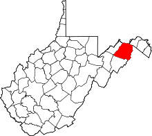
Wappocomo, West Virginia
| Wappocomo, West Virginia | |
|---|---|
| Unincorporated community | |
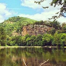 Hanging Rocks viewed from the South Branch Potomac River | |
 Wappocomo  Wappocomo | |
| Coordinates: 39°23′42″N 78°44′5″W / 39.39500°N 78.73472°WCoordinates: 39°23′42″N 78°44′5″W / 39.39500°N 78.73472°W | |
| Country | United States |
| State | West Virginia |
| County | Hampshire |
| Time zone | UTC-5 (Eastern (EST)) |
| • Summer (DST) | UTC-4 (EDT) |
| GNIS feature ID | 1549977[1] |
Wappocomo is an unincorporated community in Hampshire County in the U.S. state of West Virginia. The community is located south of Springfield on West Virginia Route 28 at Hanging Rocks along the South Branch Potomac River. Wappocomo has also historically been referred to as The Rocks, Wapocoma, and Wapocomo.
The community's name comes from the Native Americans of the area, Wappocomo meaning South Branch Potomac River in the local Indian language.[2]
Wappocomo has become a popular location on the South Branch for summer campsites with both locals and out-of-state visitors. It should not be confused with the Wapocoma Campgrounds, located five miles south of Romney on South Branch River Road (West Virginia Secondary Route 8).
Historic sites
- The Rocks, a 19th-century white clapboard farmhouse
External links
![]()
References
- ↑ U.S. Geological Survey Geographic Names Information System: Wappocomo, West Virginia
- ↑ Kenny, Hamill (1945). West Virginia Place Names: Their Origin and Meaning, Including the Nomenclature of the Streams and Mountains. Piedmont, WV: The Place Name Press. p. 656.