Springfield, West Virginia
| Springfield, West Virginia | |
|---|---|
| Census-designated place (CDP) | |
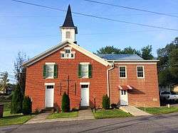 Springfield United Methodist Church | |
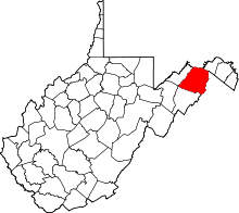
 Location of Springfield in West Virginia | |
| Coordinates: 39°27′02″N 78°41′37″W / 39.45056°N 78.69361°WCoordinates: 39°27′02″N 78°41′37″W / 39.45056°N 78.69361°W | |
| Country | United States |
| State | West Virginia |
| County | Hampshire |
| Area[1] | |
| • Total | 1.341 sq mi (3.47 km2) |
| • Land | 1.340 sq mi (3.47 km2) |
| • Water | 0.001 sq mi (0.003 km2) |
| Elevation[2] | 735 ft (224 m) |
| Population (2010)[3] | |
| • Total | 477 |
| • Density | 360/sq mi (140/km2) |
| Time zone | UTC-5 (Eastern (EST)) |
| • Summer (DST) | UTC-4 (EDT) |
| ZIP code | 26763 |
| Area code(s) | 304 |
| GNIS feature ID | 1547219[2] |
Springfield is a census-designated place (CDP) in northwestern Hampshire County in the U.S. state of West Virginia. As of the 2010 census, Springfield had a population of 477.[3] Springfield is located north of Romney along West Virginia Route 28 at its junction with Green Spring Road (West Virginia Secondary Route 1) and Springfield Pike (West Virginia Secondary Route 3). It is currently considering incorporation.
History
Established on December 16, 1790 at the "Cross Roads" of Hampshire County on the property of William and Samuel Abernethy by an act of the Virginia General Assembly,[4] Springfield was named in commemoration of the Battle of Springfield (1780).[5]
George Washington first visited the Springfield area in 1748 as a member of a party that surveyed the land holdings of Thomas Fairfax, 6th Lord Fairfax of Cameron in the South Branch Potomac River Valley.
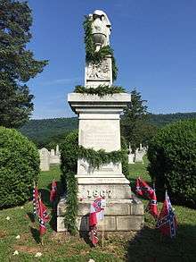
In June 1861, the town organized a company of men known as the "Potomac Guards" in support of the Confederacy. The company was under the command of Captain Philip T. Grace.[6]
On August 23, 1861, Springfield played host to an American Civil War skirmish between the Unionists and the Confederates.
Historic Sites
Today, Springfield is the site of a number of historic private residences dating from the 18th and 19th Centuries.
- 63 Springfield Pike (1860), Springfield Pike (CR 3)
- Ridgedale (George W. Washington Farm), Washington Bottom Road (CR 28/3)
- Frenchwood, Route 28 South and Market Street
- The house is currently being restored. Captain John W. Shouse supposedly built the circa 1855 brick house.
- Springfield United Methodist Church, Vine Street
Churches
- Assembly of God
- Community Bible Assembly of God Church, Poland Road (CR 28/2)
- Springfield Assembly of God Church, WV Route 28
- Methodist
- Springfield United Methodist Church, Vine Street
- Pentecostal
- Emmanuel House of Prayer, WV Route 28
- Presbyterian
- Springfield Presbyterian Church, Market Street (WV Route 28)
References

- ↑ "US Gazetteer files: 2010, 2000, and 1990". United States Census Bureau. 2011-02-12. Retrieved 2011-04-23.
- 1 2 U.S. Geological Survey Geographic Names Information System: Springfield, West Virginia. Retrieved on 2008-10-30.
- 1 2 "American FactFinder". United States Census Bureau. Retrieved 2011-05-14.
- ↑ "'An act to establish several Towns,' Hening's Statutes at Large, Vol. XIII, Chapter XLV". vagenweb.org. Retrieved 2017-03-05.
- ↑ Kenny, Hamill (1945). West Virginia Place Names: Their Origin and Meaning, Including the Nomenclature of the Streams and Mountains. Piedmont, WV: The Place Name Press. p. 596.
- ↑ "Hampshire Trivia", Hampshire Review, pp. 1A, 2007-12-27
External links
![]()