Walton (town), New York
| Walton, New York | |
|---|---|
| Town | |
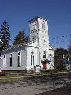 Christ Episcopal Church in Walton | |
 Walton Location in the state of New York | |
| Coordinates: 42°10′11″N 75°07′49″W / 42.16972°N 75.13028°WCoordinates: 42°10′11″N 75°07′49″W / 42.16972°N 75.13028°W | |
| Country | United States |
| State | New York |
| County | Delaware |
| Government | |
| • Type | Town Council |
| • Town Supervisor | Charles F. Gregory (R) |
| • Town Council |
Members' List
|
| Area[1] | |
| • Total | 97.62 sq mi (252.83 km2) |
| • Land | 96.84 sq mi (250.81 km2) |
| • Water | 0.78 sq mi (2.02 km2) |
| Elevation | 1,228 ft (374 m) |
| Population (2010) | |
| • Total | 5,576 |
| • Estimate (2016)[2] | 5,248 |
| • Density | 54.19/sq mi (20.92/km2) |
| Time zone | Eastern (EST) |
| ZIP code | 13856 |
| Area code(s) | 607 |
| FIPS code | 36-025-78047 |
| GNIS feature ID | 979593 |
| Website |
townofwalton |
Walton is a town in Delaware County, New York, United States. The population was 5,576 at the 2010 census.[3] The town is in the west-central part of the county and contains the village of Walton. The town claims to be the "Scarecrow Capital of the World."
Walton was formed in 1797 from the town of Franklin. The original settlement, near the site of the village of Walton, occurred in 1785.
Geography
Walton is in the west-central part of Delaware County, on both sides of the West Branch Delaware River. According to the United States Census Bureau, the town has a total area of 97.6 square miles (252.8 km2), of which 96.8 square miles (250.8 km2) is land and 0.77 square miles (2.0 km2), or 0.80%, is water.[3]
Demographics
| Historical population | |||
|---|---|---|---|
| Census | Pop. | %± | |
| 1820 | 1,432 | — | |
| 1830 | 1,672 | 16.8% | |
| 1840 | 1,846 | 10.4% | |
| 1850 | 2,271 | 23.0% | |
| 1860 | 2,740 | 20.7% | |
| 1870 | 3,216 | 17.4% | |
| 1880 | 3,544 | 10.2% | |
| 1890 | 4,543 | 28.2% | |
| 1900 | 4,869 | 7.2% | |
| 1910 | 5,088 | 4.5% | |
| 1920 | 5,425 | 6.6% | |
| 1930 | 5,111 | −5.8% | |
| 1940 | 5,220 | 2.1% | |
| 1950 | 5,724 | 9.7% | |
| 1960 | 5,753 | 0.5% | |
| 1970 | 5,882 | 2.2% | |
| 1980 | 5,839 | −0.7% | |
| 1990 | 5,953 | 2.0% | |
| 2000 | 5,607 | −5.8% | |
| 2010 | 5,576 | −0.6% | |
| Est. 2016 | 5,248 | [2] | −5.9% |
| U.S. Decennial Census[4] | |||
As of the census[5] of 2000, there were 5,607 people, 2,391 households, and 1,570 families residing in the town. The population density was 57.7 people per square mile (22.3/km²). There were 2,958 housing units at an average density of 30.4 per square mile (11.7/km²). The racial makeup of the town was 97.81% White, 0.34% Black or African American, 0.25% Native American, 0.50% Asian, 0.20% from other races, and 0.91% from two or more races. Hispanic or Latino of any race were 1.03% of the population.
There were 2,391 households out of which 28.5% had children under the age of 18 living with them, 50.4% were married couples living together, 11.0% had a female householder with no husband present, and 34.3% were non-families. 29.9% of all households were made up of individuals and 13.7% had someone living alone who was 65 years of age or older. The average household size was 2.33 and the average family size was 2.85.
In the town, the population was spread out with 23.5% under the age of 18, 6.4% from 18 to 24, 25.7% from 25 to 44, 26.5% from 45 to 64, and 17.9% who were 65 years of age or older. The median age was 42 years. For every 100 females, there were 92.7 males. For every 100 females age 18 and over, there were 88.8 males.
The median income for a household in the town was $30,550, and the median income for a family was $41,464. Males had a median income of $27,463 versus $20,000 for females. The per capita income for the town was $16,779. About 9.0% of families and 12.1% of the population were below the poverty line, including 14.7% of those under age 18 and 8.6% of those age 65 or over.
Notable inhabitants
- Jeri Laber, one of the founders of Human Rights Watch, lives in Walton.
- Everett De Morier, humorist, author, and novelist, is from Walton.[6]
Elected officials for the town of Walton:
Supervisor
- Charles F. Gregory
Town Clerk/Tax Collector Registrar of Vital Statistics
- Ronda Williams
Town Board:
- Kevin Armstrong
- Len Govern
- Patty Wood
- Luis Rodriguez
Communities and locations in the Town of Walton
- Bear Spring Mountain – An elevation located south of the village of Walton.
- Beerston – A hamlet located south-southwest of Walton.
- Colchester Mountain – An elevation located northeast of Starkweather Hill.
- Dunk Hill – An elevation located north-northeast of the village of Walton.
- Houck Mountain – An elevation located south of Bear Spring Mountain.
- Launt Pond – A small lake located south of Mount Holly.
- Loomis – A hamlet located northwest of Walton.
- Loomis Mountain – An elevation located northeast of Loomis.
- Mount Holly – An elevation located east-southeast of the village of Walton.
- Northfield – A hamlet located north-northwest of Walton.
- Oak Ridge Pond – A small lake located west-northwest of Russ Gray Pond.
- Pine Hill – An elevation located east-northeast of the village of Walton.
- Pines Brook Ridge – A ridge located northwest of the village of Walton.
- Pinesville – A hamlet located west-southwest of Walton.
- Russ Gray Pond – A small lake located west of Launt Pond.
- South Mountain – An elevation located south of the village of Walton.
- Starkweather Hill – An elevation located southeast of Mount Holly.
- Teed Pond – A small lake located west of Northfield.
- Walton – The Village of Walton. Located in the center part of the town on the West Branch Delaware River.
- Walton Mountain – An elevation located west of the village of Walton.
References
- ↑ "2016 U.S. Gazetteer Files". United States Census Bureau. Retrieved Jul 4, 2017.
- 1 2 "Population and Housing Unit Estimates". Retrieved June 9, 2017.
- 1 2 "Geographic Identifiers: 2010 Demographic Profile Data (G001): Walton town, Delaware County, New York". U.S. Census Bureau, American Factfinder. Retrieved November 9, 2015.
- ↑ "Census of Population and Housing". Census.gov. Retrieved June 4, 2015.
- ↑ "American FactFinder". United States Census Bureau. Retrieved 2008-01-31.
- ↑ "Everett De Morier". www.facebook.com. Retrieved 2018-02-23.
External links
Municipalities and communities of Delaware County, New York, United States | ||
|---|---|---|
| Towns | 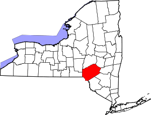 | |
| Villages | ||
| CDPs | ||
| Hamlets |
| |
| Footnotes | ‡This populated place also has portions in an adjacent county or counties | |