Walloway, South Australia
| Walloway South Australia | |||||||||||||||
|---|---|---|---|---|---|---|---|---|---|---|---|---|---|---|---|
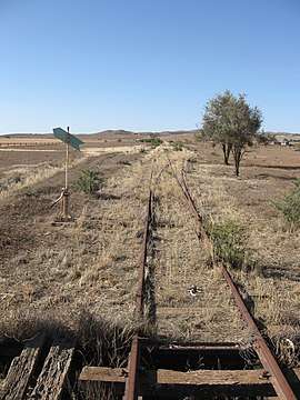 Walloway railway yard | |||||||||||||||
 Walloway | |||||||||||||||
| Coordinates | 32°38′12″S 138°35′15″E / 32.63668843°S 138.58746293°ECoordinates: 32°38′12″S 138°35′15″E / 32.63668843°S 138.58746293°E | ||||||||||||||
| Population | 6 (2016 census)[1] | ||||||||||||||
| Established | 1881[2] | ||||||||||||||
| Postcode(s) | 5431 [3] | ||||||||||||||
| Time zone | ACST (UTC+9:30) | ||||||||||||||
| • Summer (DST) | ACST (UTC+10:30) | ||||||||||||||
| Location | |||||||||||||||
| LGA(s) | District Council of Orroroo Carrieton[2] | ||||||||||||||
| Region | Yorke and Mid North [4] | ||||||||||||||
| County | Dalhousie[2] | ||||||||||||||
| State electorate(s) | Stuart[5] | ||||||||||||||
| Federal Division(s) | Grey[6] | ||||||||||||||
| |||||||||||||||
| |||||||||||||||
| Footnotes |
Coordinates[2] Locations[3][2] Climate[7] Adjoining localities[2] | ||||||||||||||
Walloway (formerly Rye) is a locality in the Australian state of South Australia located about 255 kilometres (158 mi) north of the state capital of Adelaide and about 10 kilometres (6.2 mi) north of the municipal seat of Orroroo.[2][3]
The principal land use within the locality is primary production.[2]
History
The Government Town of Walloway was surveyed in November 1881 and proclaimed with the name Rye on 30 March 1882. It was renamed as Walloway in 1940 in order to match the Wallaway railway station, which had been so named since 1851. The government town officially ceased to exist on 30 June 1988.
Being spread over the boundary joining the Hundred of Coomooroo and Hundred of Walloway, the local government first was established for the town in 1888 with the formation of the District Council of Orroroo. From 1997, the hundreds of Coomooroo and Wallaway, among thirteen hundreds in the area, became part of the larger District Council of Orroroo Carrieton.
Boundaries for the locality were formalised in December 1999 (including "the ceased Government Town of Walloway") and it was formally given the "long established name" of Wallaway, which is derived from a "native name for a large plain frequented by wild turkeys."[8][2][9]
Governance
Walloway is located within the federal division of Grey, the state electoral district of Stuart and the local government area of the District Council of Orroroo Carrieton.[6][5][2]
References
- ↑ Australian Bureau of Statistics (27 June 2017). "State Suburb of Walloway". 2016 Census QuickStats. Retrieved 14 February 2018.

- 1 2 3 4 5 6 7 8 9 10 "Placename Details: Walloway". Property Location Browser. Government of South Australia. 31 March 2010. SA0016895. Retrieved 25 October 2017.
Other Details: Town surveyed in November 1881. Originally proclaimed as Rye on 30/3/1882. Name altered in 1940 to agree with the name of the railway station. Walloway is a native name for a large plain frequented by wild turkeys. Government Town declared ceased to exist on 30/6/1988. Former name of Rye put forward to the Nomenclature Committee for name alteration by Postal Authorities due to similarity of name to Wye. Not acted upon by Nomenclature Committee. Boundaries created for the long established name in December 1999. Incorporates the ceased Government Town of Walloway.
- 1 2 3 "Postcode for Wallaway, South Australia (sic)". Retrieved 14 November 2016.
- ↑ "Yorke and Mid North SA Government region" (PDF). Government of South Australia. Retrieved 14 November 2016.
- 1 2 "District of Stuart Background Profile". Electoral Commission SA. Retrieved 26 September 2015.
- 1 2 "Federal electoral division of Grey, boundary gazetted 16 December 2011" (PDF). Australian Electoral Commission. Retrieved 20 August 2015.
- ↑ "Summary (climate) Summary statistics YONGALA (nearest weather station)". Commonwealth of Australia, Bureau of Meteorology. Retrieved 14 November 2016.
- ↑ "NEW TOWN NAMES APPROVED". The Advertiser (Adelaide). South Australia. 26 July 1940. p. 10. Retrieved 5 September 2016 – via National Library of Australia.
- ↑ "CROWN LANDS ACT 1929: SECTION 5" (PDF). South Australian Government Gazette. Government of South Australia. 30 June 1988. p. 2130. Retrieved 12 February 2017.