Black Rock, South Australia
| Black Rock South Australia | |||||||||||||||
|---|---|---|---|---|---|---|---|---|---|---|---|---|---|---|---|
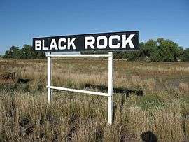 Black Rock Station Sign | |||||||||||||||
 Black Rock | |||||||||||||||
| Coordinates | 32°49′37″S 138°41′23″E / 32.827°S 138.689598°ECoordinates: 32°49′37″S 138°41′23″E / 32.827°S 138.689598°E[1] | ||||||||||||||
| Population | 36 (2016 census)[2] | ||||||||||||||
| Postcode(s) | 5431 | ||||||||||||||
| Elevation | 436 m (1,430 ft) | ||||||||||||||
| Location |
| ||||||||||||||
| LGA(s) | District Council of Orroroo Carrieton | ||||||||||||||
| State electorate(s) | Stuart | ||||||||||||||
| Federal Division(s) | Grey | ||||||||||||||
| |||||||||||||||
| Footnotes | Adjoining localities[1] | ||||||||||||||
Black Rock (formerly known as Dalton) is a hamlet in South Australia on the Black Rock Plains at the intersection of the south-north RM Williams Way (B80) between Jamestown and Orroroo and the west-east Wilmington–Ucolta Road (B56) to Peterborough, in the Mid North section of the state.
It is also the site (and name of) a former railway siding on the now removed Peterborough–Quorn railway line.[3]
Located 19 km south east of Orroroo, the town was originally laid out as "Dalton" and proclaimed on 15 December 1881. It is named after a nearby hill identified by Captain E C Frome in 1842. The town was renamed "Black Rock" in 1940 [4]
Railways
The railway line through Dalton was built in 1881, as part of the Great Northern Railway. In its day, Dalton was home to a gang, and a station master. The last commercial trains to operate through Black Rock were grain trains between Peterborough and Orroroo, in 1988.[5]
The railway connecting Black Rock to Orroroo and Peterborough was removed in late 2008. However track was left in situ in the yard, and over the Black Rock Bridge, located approximately 1 km south.[6][7] Black Rock Bridge is the longest bridge on the old Peterborough Division[5]
Black Rock Yard hosted the first of a proposed annual Kalamazoo race on 27 March 2010. The event was reported as being very successful.[3]
The town
Whilst people still live in Black Rock, the town is nearly empty.
A number of buildings still stand, including the Black Rock Hotel. This last traded commercially in the early 1980s.[5]
Name
Governor Jervois named the town. He possibly named it after Charles James Dalton who, from 1829, was an officer in the Royal Artillery and a contemporary of Governor Jervois while serving in the Royal Engineers. Alternatively he may have named it after the English town of Dalton which translates as ‘village in the dale (valley)’ or it may come from the Gaelic dall-dun - ‘dark hill’.[8]
References
- 1 2 "Search results for 'Eurelia, LOCB' with the following datasets being selected - 'Suburbs and Localities', 'Postcode', 'Counties', 'Hundreds', "Government Towns', 'Local Government Areas', 'SA Government Regions', 'Land Development Plan Zone Categories' and 'Gazetteer'". Location SA Map Viewer. Government of South Australia. Retrieved 13 February 2018.
- ↑ Australian Bureau of Statistics (27 June 2017). "State Suburb of Black Rock". 2016 Census QuickStats. Retrieved 13 February 2018.

- 1 2 "Back on the rails at Black Rock" The Northern Argus accessed 30 April 2010
- ↑ "NEW TOWN NAMES APPROVED". The Advertiser (Adelaide). South Australia. 26 July 1940. p. 10. Retrieved 5 September 2016 – via National Library of Australia.
- 1 2 3 Evans, J 2009; Proceed to Quorn Railmac Publications ISBN 978-1-86477-066-X
- ↑ Mannion, J; "Ripping up the tracks - Eurelia to Peterborough" Catchpoint Magazine March 2009 pp14-16
- ↑ Mills S. "Harvest time for the Eurelia rail line" Flinders News - 19 September 2008, accessed 10 October 2008
- ↑ South Australian Names.