Wald (Allgäu)
| Wald | ||
|---|---|---|
| ||
 Wald Location of Wald (Allgäu) within Ostallgäu district 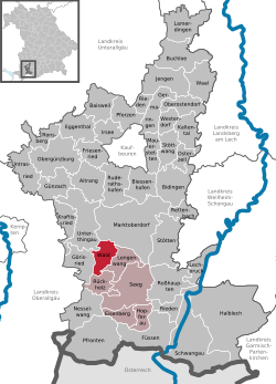 | ||
| Coordinates: 47°43′N 10°33′E / 47.717°N 10.550°ECoordinates: 47°43′N 10°33′E / 47.717°N 10.550°E | ||
| Country | Germany | |
| State | Bavaria | |
| Admin. region | Schwaben | |
| District | Ostallgäu | |
| Government | ||
| • Mayor | Josef Ampßler | |
| Area | ||
| • Total | 17.97 km2 (6.94 sq mi) | |
| Elevation | 800 m (2,600 ft) | |
| Population (2017-12-31)[1] | ||
| • Total | 1,129 | |
| • Density | 63/km2 (160/sq mi) | |
| Time zone | CET/CEST (UTC+1/+2) | |
| Postal codes | 87616 | |
| Dialling codes | 09463 | |
| Vehicle registration | OAL | |
| Website | www.wald-allgaeu.de | |

Wald is a municipality in the district of Ostallgäu in Bavaria in Germany.
The village Wald is located in the Allgäu region. The municipality of Wald belongs to the administrative community Seeg and is located in the administrative district of Bavarian Swabia.
The state-recognized recreational resort Wald includes many surrounding hamlets: Barnstein, Bergers, Birngschwend, Geigers, Gemmels, houses, Herring, Hofen, Holzmanns, Kaltenbrunn, Kaufmanns, Kippach, Klosterhof, Neupolz, Öbele, Ofen, Stechele, Wetzlers, Wies, Wimberg.
Sights
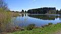 Weiher (ponds) of Wald
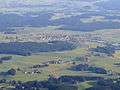 Wald from the air from the southeast
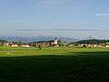 Wald from northwest
 Wertachschlucht near Wald
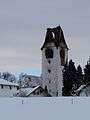 Wald - Church tower after fire, January 2012
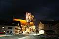 Wald at night, December 2012
External links
| Wikimedia Commons has media related to Wald (Allgäu). |
References
- ↑ "Fortschreibung des Bevölkerungsstandes". Bayerisches Landesamt für Statistik und Datenverarbeitung (in German). September 2018.
This article is issued from
Wikipedia.
The text is licensed under Creative Commons - Attribution - Sharealike.
Additional terms may apply for the media files.