Eggenthal
| Eggenthal | ||
|---|---|---|
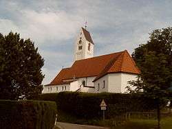 Eggenthal, church | ||
| ||
 Eggenthal Location of Eggenthal within Ostallgäu district 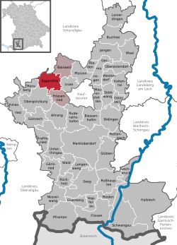 | ||
| Coordinates: 47°55′N 10°31′E / 47.917°N 10.517°ECoordinates: 47°55′N 10°31′E / 47.917°N 10.517°E | ||
| Country | Germany | |
| State | Bavaria | |
| Admin. region | Schwaben | |
| District | Ostallgäu | |
| Government | ||
| • Mayor | Hugo Greisel (FW) | |
| Area | ||
| • Total | 28.10 km2 (10.85 sq mi) | |
| Elevation | 713 m (2,339 ft) | |
| Population (2017-12-31)[1] | ||
| • Total | 1,361 | |
| • Density | 48/km2 (130/sq mi) | |
| Time zone | CET/CEST (UTC+1/+2) | |
| Postal codes | 87653 | |
| Dialling codes | 08347 | |
| Vehicle registration | OAL | |
| Website | www.eggenthal.de | |

Eggenthal is a municipality in the district of Ostallgäu in Bavaria in Germany. It is located in the Allgäu region.
There are the Gemarkungs Bayersried and Eggenthal. There are also the villages of Romatsried and Holzstetten as well as several small hamlets. In Romatsried you will find the Burgstall Romatsried, a place that may have already been populated in the Bronze Age.
Sights
 Bayersried from east
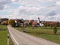
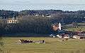 Eggenthal from southeast
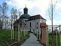 Kreuzweg
 Maria-Seelenkapelle (chapel)
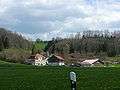 Schleifmühle
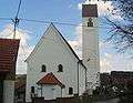 St. Afra
Notable people
- Michael Bredl (1916–1999)
References
- Eggenthal: Official statistics compiled by the Bavarian State Office of Statistics (LfStat) (PDF; 1,05 MB)
- ↑ "Fortschreibung des Bevölkerungsstandes". Bayerisches Landesamt für Statistik und Datenverarbeitung (in German). September 2018.
External links
| Wikimedia Commons has media related to Eggenthal. |
This article is issued from
Wikipedia.
The text is licensed under Creative Commons - Attribution - Sharealike.
Additional terms may apply for the media files.