Unterthingau
| Unterthingau | ||
|---|---|---|
| ||
 Unterthingau Location of Unterthingau within Ostallgäu district 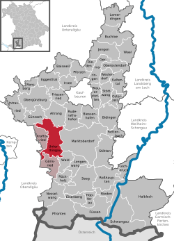 | ||
| Coordinates: 47°46′N 10°30′E / 47.767°N 10.500°ECoordinates: 47°46′N 10°30′E / 47.767°N 10.500°E | ||
| Country | Germany | |
| State | Bavaria | |
| Admin. region | Schwaben | |
| District | Ostallgäu | |
| Government | ||
| • Mayor | Bernhard Dolp | |
| Area | ||
| • Total | 45.23 km2 (17.46 sq mi) | |
| Elevation | 773 m (2,536 ft) | |
| Population (2017-12-31)[1] | ||
| • Total | 2,889 | |
| • Density | 64/km2 (170/sq mi) | |
| Time zone | CET/CEST (UTC+1/+2) | |
| Postal codes | 87647 | |
| Dialling codes | 08377 | |
| Vehicle registration | OAL / MOD / FÜS | |
| Website | www.unterthingau.de | |

Unterthingau is a municipality in the district of Ostallgäu in Bavaria in Germany.
References
- ↑ "Fortschreibung des Bevölkerungsstandes". Bayerisches Landesamt für Statistik und Datenverarbeitung (in German). September 2018.
This article is issued from
Wikipedia.
The text is licensed under Creative Commons - Attribution - Sharealike.
Additional terms may apply for the media files.