Wagenfeld
| Wagenfeld | ||
|---|---|---|
| ||
 Wagenfeld Location of Wagenfeld within Diepholz district 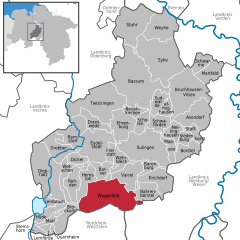  | ||
| Coordinates: 52°32′N 8°34′E / 52.533°N 8.567°ECoordinates: 52°32′N 8°34′E / 52.533°N 8.567°E | ||
| Country | Germany | |
| State | Lower Saxony | |
| District | Diepholz | |
| Government | ||
| • Mayor | Matthias Kreye | |
| Area | ||
| • Total | 117.35 km2 (45.31 sq mi) | |
| Elevation | 40 m (130 ft) | |
| Population (2017-12-31)[1] | ||
| • Total | 7,226 | |
| • Density | 62/km2 (160/sq mi) | |
| Time zone | CET/CEST (UTC+1/+2) | |
| Postal codes | 49419 | |
| Dialling codes | 0 54 44 | |
| Vehicle registration | DH | |
| Website | www.wagenfeld.de | |

Wagenfeld is a municipality in the district of Diepholz, Lower Saxony, Germany. It is situated approximately 15 km east of Diepholz, and 40 km northwest of Minden.
References
This article is issued from
Wikipedia.
The text is licensed under Creative Commons - Attribution - Sharealike.
Additional terms may apply for the media files.