Varrel
| Varrel | ||
|---|---|---|
| ||
 Varrel Location of Varrel within Diepholz district 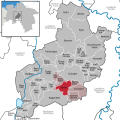  | ||
| Coordinates: 52°37′N 08°44′E / 52.617°N 8.733°ECoordinates: 52°37′N 08°44′E / 52.617°N 8.733°E | ||
| Country | Germany | |
| State | Lower Saxony | |
| District | Diepholz | |
| Municipal assoc. | Kirchdorf | |
| Government | ||
| • Mayor | Ortwin Stieglitz | |
| Area | ||
| • Total | 43.83 km2 (16.92 sq mi) | |
| Elevation | 34 m (112 ft) | |
| Population (2017-12-31)[1] | ||
| • Total | 1,530 | |
| • Density | 35/km2 (90/sq mi) | |
| Time zone | CET/CEST (UTC+1/+2) | |
| Postal codes | 27259 | |
| Dialling codes | 04274 | |
| Vehicle registration | DH | |
| Website | www.varrel.de | |

Varrel is a municipality in the district of Diepholz, in Lower Saxony, Germany.
References
This article is issued from
Wikipedia.
The text is licensed under Creative Commons - Attribution - Sharealike.
Additional terms may apply for the media files.