Sulingen
| Sulingen | ||
|---|---|---|
| ||
 Sulingen Location of Sulingen within Diepholz district 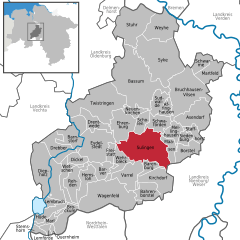  | ||
| Coordinates: 52°40′N 08°48′E / 52.667°N 8.800°ECoordinates: 52°40′N 08°48′E / 52.667°N 8.800°E | ||
| Country | Germany | |
| State | Lower Saxony | |
| District | Diepholz | |
| Government | ||
| • Mayor | Dirk Rauschkolb | |
| Area | ||
| • Total | 110.61 km2 (42.71 sq mi) | |
| Elevation | 49 m (161 ft) | |
| Population (2017-12-31)[1] | ||
| • Total | 12,799 | |
| • Density | 120/km2 (300/sq mi) | |
| Time zone | CET/CEST (UTC+1/+2) | |
| Postal codes | 27232 | |
| Dialling codes | 0 42 71 | |
| Vehicle registration | DH | |
| Website | www.sulingen.de | |

Sulingen is a town in the district of Diepholz, Lower Saxony, Germany. It is situated approximatively 30 km east of Diepholz, and 45 km south of Bremen.
Sister cities
People from Sulingen
- Liesel Westermann (born 1944), German discus thrower
References
- ↑ Landesamt für Statistik Niedersachsen, Tabelle 12411: Fortschreibung des Bevölkerungsstandes, Stand 31. Dezember 2017
- ↑ "International Relations". joniskis.lt. Retrieved 29 April 2014.
This article is issued from
Wikipedia.
The text is licensed under Creative Commons - Attribution - Sharealike.
Additional terms may apply for the media files.