Bahrenborstel
| Bahrenborstel | ||
|---|---|---|
| ||
 Bahrenborstel Location of Bahrenborstel within Diepholz district 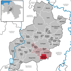  | ||
| Coordinates: 52°34′N 08°49′E / 52.567°N 8.817°ECoordinates: 52°34′N 08°49′E / 52.567°N 8.817°E | ||
| Country | Germany | |
| State | Lower Saxony | |
| District | Diepholz | |
| Municipal assoc. | Kirchdorf | |
| Government | ||
| • Mayor | Heinz Albers | |
| Area | ||
| • Total | 31.27 km2 (12.07 sq mi) | |
| Elevation | 44 m (144 ft) | |
| Population (2017-12-31)[1] | ||
| • Total | 1,098 | |
| • Density | 35/km2 (91/sq mi) | |
| Time zone | CET/CEST (UTC+1/+2) | |
| Postal codes | 27245 | |
| Dialling codes | 04273 | |
| Vehicle registration | DH | |

Bahrenborstel is a municipality in the district of Diepholz, in Lower Saxony, Germany.
It lies between the Dümmer Nature Park and the Steinhuder Nature Park, and roughly between Bremen and Minden. Approximately 7 km south of the community is the Great Moor. A few kilometers northwest runs a section of the Great Aue.
References
| Authority control |
|---|
This article is issued from
Wikipedia.
The text is licensed under Creative Commons - Attribution - Sharealike.
Additional terms may apply for the media files.