Wabag
| Wabag | |
|---|---|
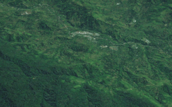 Wabag from space | |
 Wabag Location within Papua New Guinea | |
| Coordinates: 05°29′31″S 143°43′18″E / 5.49194°S 143.72167°E | |
| Country | Papua New Guinea |
| Province | Enga Province |
| District | Wabag District |
| LLG | Wabag Urban LLG |
| Elevation | 1,830 m (6,000 ft) |
| Population (2000) | |
| • Total | 4,072 |
| Languages | |
| • Main languages | Enga, Tok Pisin |
| • Traditional language | Enga |
| Time zone | UTC+10 (AEST) |
Wabag is the capital of Enga Province, Papua New Guinea. It is the least populous provincial capital in the country. It is on the Lai River; the Highlands Highway passes through the town, between Mount Hagen and Porgera. Europeans first visited the site in 1938-39[1] A radio camp and airstrip were established in 1938-39 but restrictions on transportation and the surrounding land's infertility long inhibited Wabag's development.[2]
History
A regional outpost of the Western Highlands District under the Australian Administration of Papua and New Guinea, shortly before Independence in 1975 much of the Enga-speaking region of the Western Highlands was separated into a discrete District and then, at Independence, Province with Wabag as the Provincial Headquarters.
Wabag today
There is a dense rural population and coffee and pyrethrum are widely grown in food gardens as cash crops though depredations during tribal fights and difficulties in marketing have inhibited the development of a significant commercial agriculture sector and in any case it is Mount Hagen, not Wabag, that is the commercial metropole. Law and order problems, considerable violent crime and chronic house break-ins have continue to compromise the amenity of town life.[3] A fine public library established by the Australian administration immediately before Independence in 1975 is long since dispersed, book pages being desirable for rolling cigarettes and reading books not having taken hold. The Enga Provincial Government buildings have been burned to the ground more than once. The original airstrip is closed but Air Niugini run regular flights to Port Moresby from Wapenamanda Airport about 40 minutes away by road.
Climate
Under the Koeppen climate classification Wabag is Cfb.
| Climate data for Wabag | |||||||||||||
|---|---|---|---|---|---|---|---|---|---|---|---|---|---|
| Month | Jan | Feb | Mar | Apr | May | Jun | Jul | Aug | Sep | Oct | Nov | Dec | Year |
| Average high °C (°F) | 22 (71) |
22 (71) |
22 (71) |
22 (71) |
22 (71) |
22 (71) |
21 (69) |
21 (69) |
22 (71) |
22 (71) |
22 (71) |
22 (71) |
21 (69) |
| Average low °C (°F) | 11 (51) |
11 (51) |
11 (51) |
11 (51) |
11 (51) |
10 (50) |
10 (50) |
10 (50) |
10 (50) |
10 (50) |
10 (50) |
11 (51) |
10 (50) |
| Average precipitation mm (inches) | 287 (11.3) |
297 (11.7) |
353 (13.9) |
292 (11.5) |
185 (7.3) |
140 (5.5) |
124 (4.9) |
193 (7.6) |
264 (10.4) |
267 (10.5) |
262 (10.3) |
307 (12.1) |
2,967 (116.8) |
| Source: Weatherbase[4] | |||||||||||||
Further reading
E.A. Markham. A Papua New Guinea Sojourn. Manchester: Carcanet Press Ltd, 1998. E.A. Markham was a media co-ordinator in Wabag in 1983-85 working as a VSO volunteer.
Notes
- ↑ "Wabag." Encyclopædia Britannica Online. Retrieved 4 November 2009. The noted statement in Encyclopædia Britannica is likely to be a typographical error, as the well-known and amply documented Mick and Danny Leahy expedition of 1933 proceeded on from the Wahgi Valley to the site of Wabag and then up the Ambum Valley.
- ↑ "Wabag." Encyclopædia Britannica Online. Retrieved 4 November 2009.
- ↑ E.A. Markham. A Papua New Guinea Sojourn. Manchester: Carcanet Press Ltd, 1998.
- ↑ "Weatherbase: Historical Weather for Wabag, Papua New Guinea". Weatherbase. 2011. Retrieved on November 24, 2011.
Provincial capitals of Papua New Guinea | ||
|---|---|---|