Viswema
| Viswema Viswera | |
|---|---|
| Village | |
 Viswema Location of Viswema  Viswema Viswema (India) | |
| Coordinates: 25°33′39″N 94°08′47″E / 25.5607°N 94.1463°ECoordinates: 25°33′39″N 94°08′47″E / 25.5607°N 94.1463°E | |
| Country |
|
| State | Nagaland |
| District | Kohima |
| Government | |
| • Chairman | Zhotoho Kiso |
| Elevation | 1,631 m (5,351 ft) |
| Population (2011) | |
| • Total | 7,417 |
| Languages | |
| • Official | English |
| Time zone | UTC+5:30 (IST) |
| PIN | 797005 |
| Vehicle registration | NL-01 |
| Sex ratio | 1074 ♂/♀ |
| Website |
nagaland |
Viswema is an Angami Naga village situated 22 km south of Kohima, Nagaland. With a resident population of 7417 it is the second biggest village in the state. It lies in Kohima District and is one of the oldest Tenyimi village.
As of 2017, there is an estimated 20,000 Viswemis living in the present day Viswema, Kohima and Dimapur.
The village is also known by the name 'Veshrümi' by the Chokri Chakhesangs and 'Shünamai' by the Ememei Maos
Most Chakhesang villages and also many other Angami villages point towards their origin from Viswema.
History
The history of Viswema, according to oral history begins with the founding of Kipizwü, some two km west of the village by Viswe. Viswe was a descendent of Tenyiu.
The ancestors lived there for several generations till the invasion of the Burmese-Karens, who were known to Viswemi's as Kherenümi. The defeat inflicted on the Burmese invaders gave a sense of confidence and Viswemi became more assertive and grew in great numbers. They began to move out in search of suitable environment for permanent settlement. They therefore came down to the present site of the village.
World War II
When the Japanese and INA soldiers entered Naga Hills in early April 1944, many of them stayed at the outskirt of the village. They dug trenches and built strong bunkers everywhere in the vicinity of the village. Since the Allies operation against Japanese occupation of Kohima, Viswema was continuously hit by explosive missiles which were fired by cannons from Kohima and later on from Kigwema as launching pads. Many people were killed and injured. On 10 June 1944, a message from the Allies sources was conveyed to the village elders telling them to evacuate their village. The village was evacuated the next day. Bombings on 14 June continued till the village was completely razed to the ground. The same evening the Japanese forces at Viswema retreated to the route by which they had entered Naga Hills two months back. Viswema was then taken over by the Allies.[1]
In the past Viswema was known for making fine pottery ware. For any function and rituals earthen pots were purchased from Viswema by neighboring villages.[2]
Geography and climate
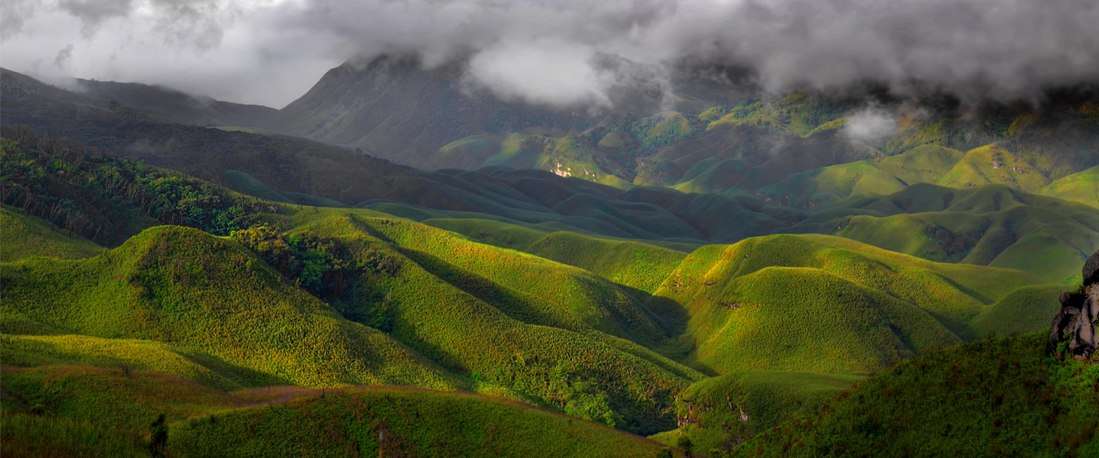
Viswema is at 25°34′N 94°08′E / 25.56°N 94.14°E. The village lies on the eastern part of the Barail mountain range. It is bounded on the east by Kidima village, on the west by Dzükou valley, on the south by Khuzama village and the boundary between them marked by a river known as Chokhwi-l or Kezo-l, on the north by Jakhama village and the boundary marked by another river known as Kerho-l.
Viswema has warm summers and cool dry winters. Snow falls occasionally on higher altitudes.
The highest peak in Viswema is Mt. Tempü. It is located above Dzükou Valley.
Demographics
The village is divided into four Thenüs namely - Zheri-mi Thenü(Z-Khel), Rachü-mi Thenü(R-Khel), Kirha-mi Thenü(K-Khel) and Pavo-mi Thenü(P-Khel).
Viswema is a large village located in Jakhama sub-division of Kohima district, Nagaland with total 1369 families residing. The village has a population of 7417 of which 3576 are males while 3841 are females as per Population Census 2011.[3]
There is an estimated 20,000 Viswemis living in the present day Viswema, Kohima and Dimapur.
In Viswema village the Average Sex Ratio is 1074 which is higher than Nagaland state average of 931. Child Sex Ratio for the Viswema as per census is 1076, higher than Nagaland average of 943.
Christianity is the dominant religion in the village, practised by almost all the its population. Baptist, Christian revival and Roman Catholic makes up the Christian population.
Culture and attractions
Festivals
Apart from the major religious festivals like Christmas, Easter, etc. the village also celebrates several local festivals.
- Te-l Khukhu is a festival that falls on 13 July (Chünyi). It is a time of giving and sharing of food with each other. This is the only festival dedicated for girls. Come July and the young damsels are abuzz with preparations for the Te-l Khukhu festival. They start collecting wild flowers in advance to decorate the particular Chokrwu (eaves at the entrance of a house) they decide on. The most common flowers are Khwüso Pü (Ginger lily, Hedychium aurantiacum wall), Phakü Pü (Rock butterfly lily, Hedychium ellepticum Buch), Terü su and Tsakoshe Pitha Nü (Tender Maize). Gone were the days when different animistic rituals were performed but with the advent of Christianity the rituals were no longer performed. Today it is celebrated as a time of get-togetherness and sharing the little you have with your dear and near ones.
Places of interests
- Dzükou Valley
The main entry to Dzükou Valley is from Viswema where one can travel to the rest house above Mt. Teyozwü by a Tata Sumo taxi. From here one has to climb forty minutes to the top of the mountain. This is where Dzükou starts but the main valley is still another two hours walk away.
- Mt. Tempü
This is the highest peak in Viswema situated at an altitude of 2994m above sea level. The best time to visit this peak is during the snow covered winter months.
- Mt. Teyozwü
This is a picturesque hill located between the village and the Dzükou valley. Some residents of the village gets refreshed just by the sight each morning even before their regular cup of morning tea. One can climb up this hill before dawn to catch up the beautiful sunrise.
- Hope garden
This is a beautiful garden located above the village on the way to Dzükou valley. One can find varieties of floras around the place. It is also a part family burial ground of a Zheri-mi clan.
Cuisines
- Za-l or commonly known as Galho among the Angamis is also a popular dish in the village. It is a mix dish made of rice, vegetables and various meats.
- Mesü, is meat cooked with pork blood. It is a common cuisine among the Tenyimis but the Mesü of Viswema is considered to be the best.
Education
Viswema village has a higher literacy rate compared to Nagaland. In 2011, the literacy rate of Viswema village was 80.69% compared to 79.55% of Nagaland. In Viswema Male literacy stands at 86.91% while female literacy rate was 74.89%.[4]
Educational Institutions in Viswema:
- St. Joseph's Higher Secondary School
- John Government Higher Secondary School
- Viswema Baptist School
The St. Joseph's College, Jakhama is located about two km from the village.
Politics
Viswema falls under Southern Angami-II Assembly Constituency of the Nagaland Legislative Assembly. The ex-Chief Minister of Nagaland Vizol Angami, hails from this village.
Notable Political Leaders:
- Vizol Angami (1914-2008), Chief Minister of Nagaland (1974-1975; 1977-1980) and the first Naga pilot (Indian Air Force during World War II)
- Dr. Vizadel Sakhrie (1943-1995), Former Minister of the Nagaland Legislative Assembly and the first Naga medical specialist.
- K. Viswesül Pusa (1954-2017), Former Minister and Veteran Congress leader.
- Er. Zale Neikha (b. 1977), Present Member of Legislative Assembly from Southern Angami-II constituency.
- Zaku Zachariah Tsükrü (1947-2017), Former Vice President of the Naga People's Front
- Er. Kropol Vitsu (b. 1964), Former Member of Legislative Assembly from Southern Angami-II constituency.
Transport
The nearest airport is Dimapur Airport at Dimapur near the Assam border about 96 kilometres (60 miles) away. Viswema is well connected by road with the Asian Highway 1 and also the NH-2 and the state highway connecting it with the various parts of Kohima district and also the neighboring Phek district through the village. Yellow taxis from Kohima to Viswema are also available. The nearest railway station is at Dimapur.