Vinegar Hill Township, Jo Daviess County, Illinois
| Vinegar Hill Township | |
|---|---|
| Township | |
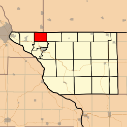 Location in Jo Daviess County | |
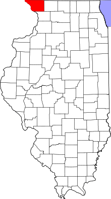 Jo Daviess County's location in Illinois | |
| Coordinates: 42°28′39″N 90°27′00″W / 42.47750°N 90.45000°WCoordinates: 42°28′39″N 90°27′00″W / 42.47750°N 90.45000°W | |
| Country | United States |
| State | Illinois |
| County | Jo Daviess |
| Established | November 2, 1852 |
| Government | |
| • Supervisor | James D. Purdy |
| Area | |
| • Total | 13.9 sq mi (36 km2) |
| • Land | 13.9 sq mi (36 km2) |
| • Water | 0 sq mi (0 km2) 0% |
| Elevation | 876 ft (267 m) |
| Population (2010) | |
| • Estimate (2016)[1] | 352 |
| • Density | 26.2/sq mi (10.1/km2) |
| Time zone | UTC-6 (CST) |
| • Summer (DST) | UTC-5 (CDT) |
| ZIP codes | 61025, 61036 |
| FIPS code | 17-085-78084 |
Vinegar Hill Township is one of twenty-three townships in Jo Daviess County, Illinois, USA. As of the 2010 census, its population was 364 and it contained 143 housing units.[2] Its name changed from Mann Township on September 18, 1857.
Geography
According to the 2010 census, the township has a total area of 13.9 square miles (36 km2), all land.[2]
Adjacent townships
- Council Hill Township (east)
- Rawlins Township (south)
- Menominee Township (west)
Major highways
Demographics
| Historical population | |||
|---|---|---|---|
| Census | Pop. | %± | |
| Est. 2016 | 352 | [1] | |
| U.S. Decennial Census[3] | |||
School districts
- Galena Unit School District 120
Political districts
- Illinois' 16th congressional district
- State House District 89
- State Senate District 45
References
- "Vinegar Hill Township, Jo Daviess County, Illinois". Geographic Names Information System. United States Geological Survey. Retrieved 2010-01-17.
- United States Census Bureau 2007 TIGER/Line Shapefiles
- United States National Atlas
- 1 2 "Population and Housing Unit Estimates". Retrieved June 9, 2017.
- 1 2 "Population, Housing Units, Area, and Density: 2010 - County -- County Subdivision and Place -- 2010 Census Summary File 1". United States Census. Retrieved 2013-05-28.
- ↑ "Census of Population and Housing". Census.gov. Retrieved June 4, 2016.
External links
- Jo Daviess County official site
- City-Data.com
- Illinois State Archives
- Township Officials of Illinois
Municipalities and communities of Jo Daviess County, Illinois, United States | ||
|---|---|---|
| Cities | ||
| Villages | ||
| Townships | ||
| CDPs | ||
| Other unincorporated communities | ||
| Ghost town | ||
This article is issued from
Wikipedia.
The text is licensed under Creative Commons - Attribution - Sharealike.
Additional terms may apply for the media files.