Derinda Township, Jo Daviess County, Illinois
| Derinda Township | |
|---|---|
| Township | |
 Location in Jo Daviess County | |
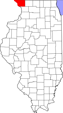 Jo Daviess County's location in Illinois | |
| Coordinates: 42°14′22″N 90°09′24″W / 42.23944°N 90.15667°WCoordinates: 42°14′22″N 90°09′24″W / 42.23944°N 90.15667°W | |
| Country | United States |
| State | Illinois |
| County | Jo Daviess |
| Established | November 2, 1852 |
| Area | |
| • Total | 37.02 sq mi (95.9 km2) |
| • Land | 36.96 sq mi (95.7 km2) |
| • Water | 0.06 sq mi (0.2 km2) 0.16% |
| Elevation | 702 ft (214 m) |
| Population (2010) | |
| • Estimate (2016)[1] | 308 |
| • Density | 8.7/sq mi (3.4/km2) |
| Time zone | UTC-6 (CST) |
| • Summer (DST) | UTC-5 (CDT) |
| ZIP codes | 61028, 61041, 61074, 61085 |
| FIPS code | 17-085-19551 |
Derinda Township is one of twenty-three townships in Jo Daviess County, Illinois, USA. As of the 2010 census, its population was 321 and it contained 176 housing units.[2]
Derinda Township was named in the 1850s for Derinda Barr, the wife of an early settler.[3]
Geography
According to the 2010 census, the township has a total area of 37.02 square miles (95.9 km2), of which 36.96 square miles (95.7 km2) (or 99.84%) is land and 0.06 square miles (0.16 km2) (or 0.16%) is water.[2]
Adjacent townships
- Woodbine Township (north)
- Stockton Township (northeast)
- Pleasant Valley Township (east)
- Woodland Township, Carroll County (southeast)
- Washington Township, Carroll County (south)
- Hanover Township (west)
- Elizabeth Township (northwest)
Cemeteries
The township contains these four cemeteries: Albright/Fehler, Massbach/St. John's Evangelical Lutheran, Trinity Lutheran/Derinda Center, and Morrison/Derinda Methodist.
Demographics
| Historical population | |||
|---|---|---|---|
| Census | Pop. | %± | |
| Est. 2016 | 308 | [1] | |
| U.S. Decennial Census[4] | |||
School districts
- River Ridge Community Unit School District 210
- Stockton Community Unit School District 206
- West Carroll Community Unit School District 314
Political districts
- Illinois' 16th congressional district
- State House District 89
- State Senate District 45
References
- "Derinda Township, Jo Daviess County, Illinois". Geographic Names Information System. United States Geological Survey. Retrieved 2010-01-17.
- United States Census Bureau 2007 TIGER/Line Shapefiles
- United States National Atlas
- 1 2 "Population and Housing Unit Estimates". Retrieved June 9, 2017.
- 1 2 "Population, Housing Units, Area, and Density: 2010 - County -- County Subdivision and Place -- 2010 Census Summary File 1". United States Census. Retrieved 2013-05-28.
- ↑ Callary, Edward (29 September 2008). Place Names of Illinois. University of Illinois Press. p. 92. ISBN 978-0-252-09070-7.
- ↑ "Census of Population and Housing". Census.gov. Retrieved June 4, 2016.
External links
- Jo Daviess County official site
- City-Data.com
- Illinois State Archives
- Township Officials of Illinois
Municipalities and communities of Jo Daviess County, Illinois, United States | ||
|---|---|---|
| Cities | ||
| Villages | ||
| Townships | ||
| CDPs | ||
| Other unincorporated communities | ||
| Ghost town | ||
This article is issued from
Wikipedia.
The text is licensed under Creative Commons - Attribution - Sharealike.
Additional terms may apply for the media files.