Vilas, North Carolina
| Vilas, North Carolina | |
|---|---|
| Unincorporated community | |
 Vilas, North Carolina  Vilas, North Carolina | |
| Coordinates: 36°14′44″N 81°46′03″W / 36.24556°N 81.76750°WCoordinates: 36°14′44″N 81°46′03″W / 36.24556°N 81.76750°W | |
| Country | United States |
| State | North Carolina |
| County | Watauga |
| Elevation | 2,746 ft (837 m) |
| Time zone | UTC-5 (Eastern (EST)) |
| • Summer (DST) | UTC-4 (EDT) |
| ZIP code | 28692 |
| Area code(s) | 828 |
| GNIS feature ID | 1023082[1] |
Vilas is an unincorporated community in Watauga County, North Carolina, United States. The community is located on U.S. Route 321 and U.S. Route 421 5.6 miles (9.0 km) west-northwest of Boone. Vilas has a post office with ZIP code 28692.[2][3]
References
- ↑ "Vilas". Geographic Names Information System. United States Geological Survey.
- ↑ United States Postal Service (2015). "USPS - Look Up a ZIP Code". Retrieved February 13, 2015.
- ↑ "Postmaster Finder - Post Offices by ZIP Code". United States Postal Service. Retrieved February 13, 2015.
Municipalities and communities of Watauga County, North Carolina, United States | ||
|---|---|---|
| Towns | 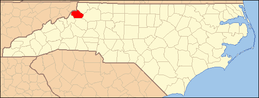 | |
| CDPs | ||
| Unincorporated communities | ||
| Footnotes | ‡This populated place also has portions in an adjacent county or counties | |
This article is issued from
Wikipedia.
The text is licensed under Creative Commons - Attribution - Sharealike.
Additional terms may apply for the media files.