Foscoe, North Carolina
| Foscoe | |
|---|---|
| Unincorporated community | |
 Foscoe Location within the state of North Carolina | |
| Coordinates: 36°09′42″N 81°45′56″W / 36.16167°N 81.76556°WCoordinates: 36°09′42″N 81°45′56″W / 36.16167°N 81.76556°W | |
| Country | United States |
| State | North Carolina |
| County | Watauga County |
| Elevation | 3,041 ft (927 m) |
| Time zone | UTC-5 (Eastern (EST)) |
| • Summer (DST) | UTC-4 (EDT) |
| ZIP code | 28607 |
| Area code(s) | 828 |
| GNIS feature ID | 1020333[1] |
Foscoe is an unincorporated community and census-designated place in Watauga County, North Carolina, United States. The community is located on NC 105, southwest of Boone.
The community is between Seven Devils and Shulls Mill.[2] Multiple shops dot the main highway, serving a tourist clientele. Its development, since the 1980s, is thanks to year-round tourism to nearby attractions, notably Grandfather Mountain.
Historically, the East Tennessee and Western North Carolina Railroad (Nicknamed "Tweetsie") passed through the area until flooding destroyed the tracks in 1940. In 1956, NC 105 was built over the original rail bed.
See also
References
- ↑ "Foscoe, North Carolina". Geographic Names Information System. United States Geological Survey. Retrieved 2011-09-10.
- ↑ "Shulls Mill, North Carolina". Geographic Names Information System. United States Geological Survey. Retrieved 2011-09-10.
Municipalities and communities of Watauga County, North Carolina, United States | ||
|---|---|---|
| Towns | 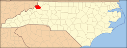 | |
| CDPs | ||
| Unincorporated communities | ||
| Footnotes | ‡This populated place also has portions in an adjacent county or counties | |
This article is issued from
Wikipedia.
The text is licensed under Creative Commons - Attribution - Sharealike.
Additional terms may apply for the media files.