Cove Creek, North Carolina
| Cove Creek, North Carolina | |
|---|---|
| Unincorporated community | |
 Cove Creek, North Carolina  Cove Creek, North Carolina | |
| Coordinates: 36°16′35″N 81°46′58″W / 36.27639°N 81.78278°WCoordinates: 36°16′35″N 81°46′58″W / 36.27639°N 81.78278°W | |
| Country | United States |
| State | North Carolina |
| County | Watauga |
| Area[1] | |
| • Total | 8.513 sq mi (22.05 km2) |
| • Land | 8.509 sq mi (22.04 km2) |
| • Water | 0.004 sq mi (0.01 km2) |
| Elevation | 2,795 ft (852 m) |
| Population (2010)[1] | |
| • Total | 1,171 |
| • Density | 140/sq mi (53/km2) |
| Time zone | UTC-5 (Eastern (EST)) |
| • Summer (DST) | UTC-4 (EDT) |
| Area code(s) | 828 |
| GNIS feature ID | 2584313[2] |
Cove Creek is an unincorporated community and census-designated place in Watauga County, North Carolina, United States. Its population was 1,171 as of the 2010 census.[1]
Geography
According to the U.S. Census Bureau, the community has an area of 8.513 square miles (22.05 km2); 8.509 square miles (22.04 km2) of its area is land, and 0.004 square miles (0.010 km2) is water.[1]
References
Municipalities and communities of Watauga County, North Carolina, United States | ||
|---|---|---|
| Towns | 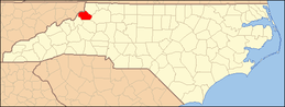 | |
| CDPs | ||
| Unincorporated communities | ||
| Footnotes | ‡This populated place also has portions in an adjacent county or counties | |
This article is issued from
Wikipedia.
The text is licensed under Creative Commons - Attribution - Sharealike.
Additional terms may apply for the media files.