Vigo, Indiana
| Vigo, Indiana | |
|---|---|
| Unincorporated community | |
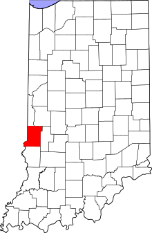 Vigo County's location in Indiana | |
 Vigo Location in Vigo County, Indiana | |
| Coordinates: 39°17′14″N 87°32′14″W / 39.28722°N 87.53722°WCoordinates: 39°17′14″N 87°32′14″W / 39.28722°N 87.53722°W | |
| Country | United States |
| State | Indiana |
| County | Vigo |
| Township | Prairie Creek |
| Elevation[1] | 456 ft (139 m) |
| Time zone | UTC-5 (Eastern (EST)) |
| • Summer (DST) | UTC-4 (EDT) |
| ZIP code | 47802 |
| Area code(s) | 812, 930 |
| GNIS feature ID | 445288 |
Vigo is a small unincorporated community in Prairie Creek Township, Vigo County, in the U.S. state of Indiana.[2] The community is in the 47802 zip code,[3] the Wabash Valley and the Terre Haute Metropolitan Statistical Area.
History
A post office was established at Vigo in 1844, and remained in operation until it was discontinued in 1905.[4]
Geography
Vigo is located at 39°17′14″N 87°32′14″W / 39.28722°N 87.53722°W, about 6 miles (9.7 km) southwest of Terre Haute, the county seat.
References
- ↑ "US Board on Geographic Names". United States Geological Survey. 2007-10-25. Retrieved 2008-01-31.
- ↑ "Vigo, Indiana". Geographic Names Information System. United States Geological Survey. Retrieved August 7, 2017.
- ↑ "Indiana Township Association page for Vigo County". Archived from the original on July 5, 2008. Retrieved 2009-01-26.
- ↑ "Vigo County". Jim Forte Postal History. Retrieved July 14, 2016.
Municipalities and communities of Vigo County, Indiana, United States | ||
|---|---|---|
| City | ||
| Towns | ||
| Townships | ||
| CDPs | ||
| Other unincorporated communities |
| |
| Footnotes | ‡This populated place also has portions in an adjacent county or counties | |
This article is issued from
Wikipedia.
The text is licensed under Creative Commons - Attribution - Sharealike.
Additional terms may apply for the media files.