Taylorville, Indiana
| Taylorville, Indiana | |
|---|---|
| Unincorporated community | |
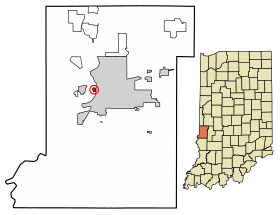 Location of Taylorville in Vigo County, Indiana. | |
| Coordinates: 39°27′45″N 87°25′25″W / 39.46250°N 87.42361°WCoordinates: 39°27′45″N 87°25′25″W / 39.46250°N 87.42361°W | |
| Country | United States |
| State | Indiana |
| County | Vigo |
| Township | Sugar Creek |
| Elevation[1] | 469 ft (143 m) |
| Time zone | UTC-5 (Eastern (EST)) |
| • Summer (DST) | UTC-4 (EDT) |
| ZIP code | 47885 |
| Area code(s) | 812, 930 |
| FIPS code | 18-18658 |
| GNIS feature ID | 444608 |
Taylorville, also known as Taylorsville or Dresser, is an unincorporated community in eastern Sugar Creek Township, Vigo County, in the U.S. state of Indiana.[2] It is part of the Terre Haute metropolitan area. Though the United States Board on Geographic Names has officially designated the area as Taylorville, the 2010 United States Census considered the area a census designated place called Dresser.[3]
History
Taylorville was founded in 1908, and was named after a local farmer named Taylor.[4] A post office was established under the name Dresser in 1932, and remained in operation until it was discontinued in 1935.[5]
Geography
Taylorville is located at 39°27′45″N 87°25′25″W / 39.46250°N 87.42361°W at an elevation of 591 feet. Located very near the Wabash River, the town is nestled between Terre Haute and West Terre Haute.
Demographics
| Historical population | |||
|---|---|---|---|
| Census | Pop. | %± | |
| U.S. Decennial Census[6] | |||
References
- ↑ "US Board on Geographic Names". United States Geological Survey. October 25, 2007. Retrieved 2016-07-13.
- ↑ "Taylorville, Indiana". Geographic Names Information System. United States Geological Survey. Retrieved August 6, 2017.
- ↑ "Dresser Census Designated Place". Geographic Names Information System. United States Geological Survey. Retrieved 2010-06-25.
- ↑ Baker, Ronald L. (October 1995). From Needmore to Prosperity: Hoosier Place Names in Folklore and History. Indiana University Press. p. 320. ISBN 978-0-253-32866-3.
...was named in 1908 for a farmer called Captain Taylor.
- ↑ "Vigo County". Jim Forte Postal History. Retrieved July 13, 2016.
- ↑ "Census of Population and Housing". Census.gov. Retrieved June 4, 2016.
Municipalities and communities of Vigo County, Indiana, United States | ||
|---|---|---|
| City | ||
| Towns | ||
| Townships | ||
| CDPs | ||
| Other unincorporated communities |
| |
| Footnotes | ‡This populated place also has portions in an adjacent county or counties | |