Sandford, Indiana
| Sandford, Indiana | |
|---|---|
| Unincorporated community | |
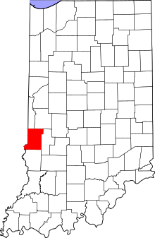 Vigo County's location in Indiana | |
 Sandford Location in Vigo County, Indiana | |
| Coordinates: 39°32′43″N 87°31′50″W / 39.54528°N 87.53056°WCoordinates: 39°32′43″N 87°31′50″W / 39.54528°N 87.53056°W | |
| Country | United States |
| State | Indiana |
| County | Vigo |
| Township | Fayette |
| Elevation[1] | 630 ft (192 m) |
| Time zone | UTC-5 (Eastern (EST)) |
| • Summer (DST) | UTC-4 (EDT) |
| ZIP code | 47885 |
| Area code(s) | 812, 930 |
| FIPS code | 18-67824[2] |
| GNIS feature ID | 442999 |
Sandford is an unincorporated community in Fayette Township, Vigo County, in the U.S. state of Indiana.[3]
The community is part of the Terre Haute Metropolitan Statistical Area.
History
Sandford was established in 1854 at the state line between Illinois and Indiana. With the building of the Indianapolis & St. Louis Railroad, it became an important town in the area. In 1890 it had a population of approximately 250.[4]
A post office was established at Sandford in 1855, and remained in operation until it was discontinued in 1995.[5]
Geography
Sandford is located at 39°32′43″N 87°31′50″W / 39.54528°N 87.53056°W.
References
- ↑ "US Board on Geographic Names". United States Geological Survey. 2007-10-25. Retrieved 2008-01-31.
- ↑ "American FactFinder". United States Census Bureau. Retrieved 2008-01-31.
- ↑ "Sandford, Indiana". Geographic Names Information System. United States Geological Survey. Retrieved August 7, 2017.
- ↑ Bradsby, H.C. (1891). History of Vigo County, Indiana, with Biographical Selections. Chicago: S. B. Nelson & Co. p. 481.
- ↑ "Vigo County". Jim Forte Postal History. Retrieved July 14, 2016.
Municipalities and communities of Vigo County, Indiana, United States | ||
|---|---|---|
| City | ||
| Towns | ||
| Townships | ||
| CDPs | ||
| Other unincorporated communities |
| |
| Footnotes | ‡This populated place also has portions in an adjacent county or counties | |
This article is issued from
Wikipedia.
The text is licensed under Creative Commons - Attribution - Sharealike.
Additional terms may apply for the media files.