Silver Hills, Kozhikode
Silver Hills, or Velli-madu-kunnu is a residential area in the city of Kozhikode (Calicut), in India.
| Vellimadukunnu , Kozhikode. /SilverHills | |
|---|---|
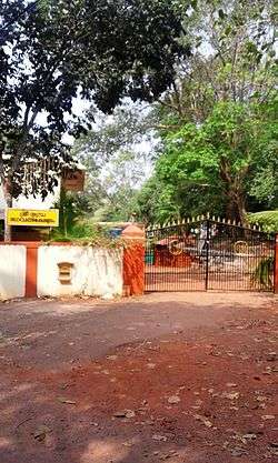 Numbra Bhagavathy Temple | |
| Coordinates: 11°17′26″N 75°49′48″E / 11.29062°N 75.83004°E | |
| Country | India |
| State | Kerala |
Etymology
Vellimadukunnu means Silver Hills in Malayalam language. The places Poolakadavu, NGO quarters, Maloorkunnu, Patroni Nagar, Ambili Nagar, Marikkunu, East Vellimadukunnu are generally called Vellimadkunnu. The post office which serves the area is at Marikkunnu. The nearest river is at Poolakadavu and the Britisher's time police camp is at Maloorkunnu. The meaning of vellimadukunnu (velli=silver, kunnu=hill, madu= referred to domestic animals like cow, buffalo, pig etc.). Nobody knows the reason how the place got this name. Vellimadukunnu is often translated as "Silver Hills" in English.
Places
Major places collectively called Vellimadkunnu are:
- Poolakadavu
- NGO Quarters (Kanhirathinkal)
- Maloorkunnu
- Merikunnu
- Patroni Nagar
- Ambili Nagar
- Madhyamam/East Vellimadkunnu
Transportation
Vellimadukunnu is well connected with roads from Kozhikode town, Kovoor, Kunnamangalam. There are public and private transport system that run in these roads.
JDT Ground
JDT Ground is the hub of all sports lovers of Vellimadkunnu. At evenings and morning you can see kids and elders playing in this football ground. It has been the venue for many football, cricket tournaments and art festivals including the Kalolsavam.
Wayanad Road
Wayanad Road begins from Nadakkavu area in Kozhikode. After passing through the Eranhippalam junction, the major locations are the Civil Station and the Iqra Hospital areas. After the Malapparamba junction, Wayanad Road continues through NGO Quarters, Law College, Nirmala Hospital, Merikkkunnu, Madhyamam Press and reaches Moozhikkal village. The next localities are Chelavoor and Markaz town. The road further passes through Koduvally and Thamarassery before going up to Wayanad hills.
Major organizations
See also
Image gallery
 Nirmala Hospital, JDT junction
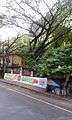 Civil Station
Location
Areas Of Calicut | ||||||||||
|---|---|---|---|---|---|---|---|---|---|---|
| ||||||||||
References
External links
Coordinates: 11°17′38″N 75°49′13″E / 11.29395°N 75.82038°E