Maniyur
| Maniyur | |
|---|---|
| Grama Panchayath | |
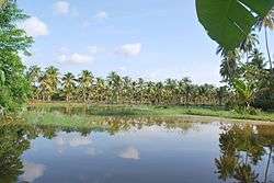 Paddy Fields in Winter in Maniyoor | |
 Maniyur Location in Kerala, India  Maniyur Maniyur (India) | |
| Coordinates: 11°32′0″N 75°39′0″E / 11.53333°N 75.65000°ECoordinates: 11°32′0″N 75°39′0″E / 11.53333°N 75.65000°E | |
| Country |
|
| State | Kerala |
| District | Kozhikode |
| Population (2001) | |
| • Total | 20,846 |
| Languages | |
| • Official | Malayalam, English |
| Time zone | UTC+5:30 (IST) |
| ISO 3166 code | IN-KL |
| Vehicle registration | KL-18 , KL-56 |
Maniyur is a village in Kozhikode district in the state of Kerala, India.[1]
Demographics
As of 2001 India census, Maniyur had a population of 20846 with 9985 males and 10861 females.[1]
Transportation
Maniyur village connects to other parts of India through Vatakara city on the west and Kuttiady town on the east. National highway No.66 passes through Vatakara and the northern stretch connects to Goa and Mumbai. The southern stretch connects to Cochin and Trivandrum. The eastern Highway going through Kuttiady connects to Mananthavady, Mysore and Bangalore. The nearest airports are at Kannur and Kozhikode. The nearest railway station is at Vatakara.
References
- 1 2 "Census of India : Villages with population 5000 & above". Registrar General & Census Commissioner, India. Archived from the original on 2008-12-08. Retrieved 2008-12-10.
This article is issued from
Wikipedia.
The text is licensed under Creative Commons - Attribution - Sharealike.
Additional terms may apply for the media files.