Van Hook, North Dakota
| Van Hook, North Dakota | |
|---|---|
| former Ghost town currently a thriving resort town | |
| Coordinates: 47°56′42″N 102°21′36″W / 47.945°N 102.36°WCoordinates: 47°56′42″N 102°21′36″W / 47.945°N 102.36°W | |
| Country | United States |
| State | North Dakota |
| County | Mountrail |
| Founded | 1914 |
| Incorporated[1] | 1915 |
| Disincorporated[2] | 1953 |
| Elevation | 1,850 ft (560 m) |
| Time zone | UTC-6 (Central (CST)) |
| • Summer (DST) | UTC-5 (CDT) |
| Area code(s) | 701 |


Van Hook is currently a thriving resort community built on the shores of Lake Sakakawea. The town was disbanded in the 1950s with the flooding of Lake Sakakawea and for a very short period of time was classified as a ghost town in the north central United States, located in Van Hook Township in Mountrail County, North Dakota. The original town site was mostly left not flooded when Lake Sakakawea was formed in the 1950s behind Garrison Dam, Many residents in the 1950s moved to New Town. Since most of the old townsite was never actually flooded by Lake Sakakawea, the townsite has become a thriving resort town still called Van Hook with both summer and permanent populations.[2] Lake Sakakawea's Van Hook Arm gets its name from the town.
History
Van Hook was founded in 1914 as a station on the Soo Line Railroad. It is named after Fred Van Hook, who was one of the first to survey the area in 1911. It was incorporated in 1915, and reported a population of 372 in 1930.[3] In fact, the town grew so fast that it earned the nickname "The City of Speed."[2]
When the Garrison Dam was built in the early 1950s, forming Lake Sakakawea, the town's residents relocated to New Town, which the government had built to house those displaced by the dam. Residents from Sanish, which was also flooded, also moved here. The town's last reported population in 1950 was 380.[1][4] The current population of the unincorporated resort area/town is not known, but in the summer with temporary residents may exceed the 1950 number of 380.
References
- 1 2 North Dakota Secretary of State (1989). North Dakota Centennial Blue Book. Bismarck, ND: North Dakota Legislative Assembly. p. 512. OCLC 20074974.
- 1 2 3 Wick, Douglas A. (1988). North Dakota Place Names. Bismarck, North Dakota: Hedemarken Collectibles. ISBN 0-9620968-0-6. OCLC 191277027.
- ↑ U.S. Census Bureau (1931). "Number and Distribution of Inhabitants, North Dakota" (PDF). Fifteenth Census of the United States: 1930. Government Printing Office. Retrieved 2008-07-20.
- ↑ U.S. Census Bureau (1952). "Number of Inhabitants, North Dakota" (PDF). Census of Population: 1950. Government Printing Office. Retrieved 2008-07-20.
External links
Municipalities and communities of Mountrail County, North Dakota, United States | ||
|---|---|---|
| Cities | 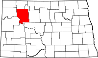 | |
| Townships |
| |
| Unorganized territory |
| |
| Unincorporated communities | ||
| Ghost town | ||
| Indian reservation | ||
| Footnotes | ‡This populated place also has portions in an adjacent county or counties | |