Istaravshan
| Istaravshan | |
|---|---|
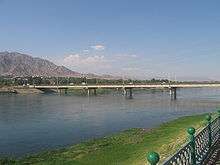
.jpg) Overview of Istaravshan | |
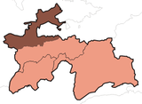
 Istaravshan Location in Tajikistan | |
| Coordinates: 39°54′39″N 69°00′23″E / 39.91083°N 69.00639°E | |
| Country |
|
| Province | Sughd Province |
| Elevation[1] | 992 m (3,255 ft) |
| Population (2007 est.)[2] | |
| • Total | 60,200 |
| Time zone | UTC+5 |
Istaravshan (Tajik: Истаравшан; Persian: استروشن) is a city in Sughd Province in Tajikistan. Located in the northern foothills of the Turkistan mountain range, 78 kilometers southwest of Khujand, Istaravshan is one of the oldest cities in today's Tajikistan, having existed for more than 2500 years. Before 2000, it was known as Ура́-Тюбе (Ura-Tyube) in Russian, Ӯротеппа (Ūroteppa) in Tajik and O‘ratepa in Uzbek, the native language of the locals. In 2000, the Tajik authorities decided to delete Uzbek names in country's map and renamed the Uzbek name of the city from O‘ratepa into Istaravshan, the process called as forced "Tajikization" or "Persification" by many.
Bordered by Uzbekistan in the north and west, and Kyrgyzstan in the east, the territorial area of Istaravshan stretches 1,830 square kilometers, and with an administrative population of 199,000 people, the majority of its citizens live in the outlying countryside.
The city lies on the main road connecting Tajikistan's two largest cities, Khujand and Dushanbe.
Historical importance
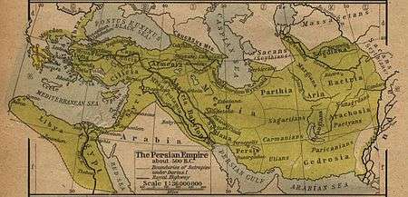
The accompanying 1923 map of gives the location of the ancient city of Cyropolis as being a very close approximation to that of modern-day Istaravshan.
Coordinates: 39°54′39″N 69°00′23″E / 39.91083°N 69.00639°E
Climate
In Istaravshan, the climate is mild and temperate. There is more rainfall in winter than in summer. The Köppen-Geiger climate classification is Csa. The average annual temperature in Istaravshan is 12.2 °C (54.0 °F). About 485 mm (19.09 in) of precipitation falls annually.
| Climate data for Istaravshan | |||||||||||||
|---|---|---|---|---|---|---|---|---|---|---|---|---|---|
| Month | Jan | Feb | Mar | Apr | May | Jun | Jul | Aug | Sep | Oct | Nov | Dec | Year |
| Average high °C (°F) | 3.2 (37.8) |
5.3 (41.5) |
11.2 (52.2) |
18.9 (66) |
24.5 (76.1) |
30.2 (86.4) |
32.8 (91) |
31.4 (88.5) |
26.7 (80.1) |
19.1 (66.4) |
11.2 (52.2) |
5.4 (41.7) |
18.3 (65) |
| Average low °C (°F) | −5 (23) |
−3.4 (25.9) |
1.8 (35.2) |
7.6 (45.7) |
11.5 (52.7) |
15.3 (59.5) |
17.3 (63.1) |
15.3 (59.5) |
10.3 (50.5) |
5.3 (41.5) |
0.7 (33.3) |
−2.5 (27.5) |
6.2 (43.1) |
| Average precipitation mm (inches) | 56 (2.2) |
53 (2.09) |
81 (3.19) |
80 (3.15) |
60 (2.36) |
12 (0.47) |
6 (0.24) |
1 (0.04) |
6 (0.24) |
38 (1.5) |
38 (1.5) |
54 (2.13) |
370 (14.57) |
| Source: climate-data | |||||||||||||
Istaravshan on stamps
 Stamps of Tajikistan, 2002
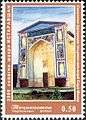 Stamps of Tajikistan, 2002
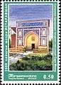 Stamps of Tajikistan, 2002
 Stamps of Tajikistan, 2002
See also
References
- ↑ "Climate of Vose'". Weatherbase.com. Retrieved 2 August 2014.
- ↑ Population of the Republic of Tajikistan as of 1 January 2008, State Committee of Statistics, Dushanbe, 2008 (in Russian)
External links
| Wikimedia Commons has media related to Istarawshan. |