Upper West Region
| Upper West Region, Dagbon | |
|---|---|
| Region | |
| Région du Haut Ghana occidental | |
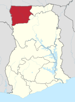 Location of Upper West Region in Ghana | |
| Country | Ghana |
| Capital | Wa |
| Districts | 11 |
| Government | |
| • Regional Minister | Sulemana Alhassan[1] |
| Area[2] | |
| • Total | 18,476 km2 (7,134 sq mi) |
| Area rank | Ranked 7th |
| Population (2010 Census)[3] | |
| • Total | 702,110 |
| • Rank | Ranked 10th |
| • Density | 38/km2 (98/sq mi) |
| GDP (PPP) | |
| • Year | 2013 |
| • Per capita | $5,150 |
| GDP (Nominal) | |
| • Year | 2013 |
| • Per capita | $2,500 |
| Time zone | GMT |
| Area code(s) | 039 |
| ISO 3166 code | GH-UW |
The Upper West Region of Ghana is located in the north-western corner of Ghana, and is bordered by Upper East region to the east, Northern region to the south, and Burkina Faso to the west and north. The Upper West regional capital and largest settlement is Wa. Upper West is the youngest region to have been created in Ghana by the then Head of State, Flight-Lieutenant Jerry Rawlings in 1983 under the Provisional National Defence Council (PNDC). The area was carved out of the former Upper Region, which is now the Upper East Region.
Geography and climate
Location and size
The Upper West Region is one of the ten regions of Ghana. It is located at the North Western corner of Ghana with latitude 9.8°- 11.O° North and longitude 1.6°- 3.0 West, bounded to Burkina Faso to the North.It covers a geographical area of 18,476 square kilometres which represents 12.7% of the total land area of Ghana. The northern Ghana-Burkina Faso border, on the east by the Upper East region and Northern region, on the south by the Northern region, and on the west by the western Ghana-Burkina Faso border borders the Upper West region on the north. It is the seventh largest region in Ghana in total area, and it is made up of eleven (11) districts. By virtue of its location, it has the potential for international and inter-regional trade and other bi-lateral relations, but the overspill of criminal activities and disaster, such as bush fires, diseases and pestilence, armed robbery etc., from our neighbours also pose a threat to the region.[4]
Tourism
The Wechiau Hippopotamus Sanctuary is located South West of Wa, along the Black Volta River in the Wa West District. There is also the Gwollu Wall in the Sissala District which also serves as the hometown of one of Ghana's past presidents - Dr. Hilla Limann.[5]
Cuisine
A distinctive feature of the Upper West region's culture is the brewing of pito (pronounced PEE-toe) a sweet, mildly alcoholic beverage derived from sorghum (Sorghum spp.). Pito is sold by the brewers in open-air bars and drunk from calabashes.
Economy
The major economic activity of the region is agriculture. Crops grown include corn, millet, peanuts, okra, shea tree, and rice. Sheep, goats, chickens, pigs and guinea fowl are raised for meat and eggs. Because the region's dry season is long, extending roughly from October to May, many people leave the region to work in the southern part of Ghana for at least part of the year.
Sports
Districts
.svg.png)
The Upper West Region of Ghana contains 11 districts consisting of 1 municipal and 10 ordinary districts as follows:[6]
| Districts in Upper West Region | |||
|---|---|---|---|
| # | District | Capital | Population |
| 1 | Daffiama Bussie Issa | Issa | |
| 2 | Jirapa/Lambussie | Jirapa | |
| 3 | Lambussie Karni | Lambussie | |
| 4 | Lawra | Lawra | |
| 5 | Nadowli | Nadowli | |
| 6 | Nandom | Nandom | |
| 7 | Sissala East | Tumu | |
| 8 | Sissala West | Gwollu | |
| 9 | Wa East | Funsi | |
| 10 | Wa Municipal | Wa | |
| 11 | Wa West | Wechiau | |
| Total | |||
Notable natives of Upper West Region
Prominent and famous citizens of Upper West Region include
- President Hilla Limann from Gwollu,
- Cardinal Peter Poreku Dery from Nandom,
- Peter Nanfuri from Jirapa,
- Kwesi Nyantakyi from Wa,
- Samini from Wa,
- Wiyaala from Wa,
- Benjamin Kunbuor from Nandom,
- Alban Bagbin from Sombo and
- Abdul-Rashid Pelpuo from Wa.
- Archbishop Emeritus Gregory Kpiebaya, Nanvilli
References
- ↑ "Sulemana Alhassan – Upper West Region". Government of Ghana.
- ↑ "Upper West Region". GhanaDistricts.com. Retrieved 2009-11-20.
- ↑ "Upper West Region – Population" (PDF). statsghana.gov.gh. Retrieved 2013-01-20.
- ↑ GOG(MLGRD)
- ↑ ghanadistricts.com
- ↑ "Upper West". GhanaDistricts.com. Archived from the original on 18 January 2013. Retrieved 15 January 2013.
Sources
- "Districts of Ghana". Statoids.
- GhanaDistricts.com
Places adjacent to Upper West Region | ||||||||||
|---|---|---|---|---|---|---|---|---|---|---|
| ||||||||||
| Municipal |
| |
|---|---|---|
| District |
| |