Turnip Hole, Pennsylvania
| Turnip Hole, Pennsylvania | |
|---|---|
| Unincorporated community | |
 Turnip Hole Location within the state of Pennsylvania | |
| Coordinates: 41°9′9″N 79°35′21″W / 41.15250°N 79.58917°WCoordinates: 41°9′9″N 79°35′21″W / 41.15250°N 79.58917°W | |
| Country | United States |
| State | Pennsylvania |
| County | Clarion |
| Township | Licking |
| Elevation | 1,158 ft (353 m) |
| Time zone | UTC-5 (Eastern (EST)) |
| • Summer (DST) | UTC-4 (EDT) |
| GNIS feature ID | 1189966[1] |
Turnip Hole is an unincorporated community in Clarion County, Pennsylvania, United States.
A post office called Turnip Hole was established in 1889, and remained in operation until it was discontinued in 1911.[2] Turnip Hole has been noted for its colorful place name.[3]
References
- ↑ U.S. Geological Survey Geographic Names Information System: Turnip Hole, Pennsylvania
- ↑ "Clarion County". Jim Forte Postal History. Retrieved 1 October 2014.
- ↑ Standard, Defense (29 November 2010). The Best of DEFENSE STANDARD, 2007-2010. BookBrewer. p. 528. ISBN 978-1-61156-022-0.
Municipalities and communities of Clarion County, Pennsylvania, United States | ||
|---|---|---|
| Boroughs | 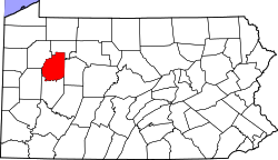 | |
| Townships | ||
| CDPs | ||
| Unincorporated communities | ||
| Footnotes | ‡This populated place also has portions in an adjacent county or counties | |
This article is issued from
Wikipedia.
The text is licensed under Creative Commons - Attribution - Sharealike.
Additional terms may apply for the media files.