Hawthorn, Pennsylvania
| Hawthorn, Pennsylvania | |
|---|---|
| Borough | |
 Houses on Main Street; the Methodist church is at left | |
 Location of Hawthorn in Clarion County, Pennsylvania. | |
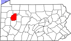 Map showing Clarion County in Pennsylvania | |
 Hawthorn Location in Pennsylvania | |
| Coordinates: 41°01′14″N 79°16′27″W / 41.02056°N 79.27417°WCoordinates: 41°01′14″N 79°16′27″W / 41.02056°N 79.27417°W | |
| Country | United States |
| State | Pennsylvania |
| County | Clarion |
| Incorporated | 1916 |
| Government | |
| • Type | Borough Council |
| Area[1] | |
| • Total | 1.08 sq mi (2.81 km2) |
| • Land | 1.02 sq mi (2.65 km2) |
| • Water | 0.06 sq mi (0.15 km2) |
| Elevation | 1,105 ft (337 m) |
| Population (2010) | |
| • Total | 494 |
| • Estimate (2016)[2] | 462 |
| • Density | 450.73/sq mi (174.08/km2) |
| Time zone | UTC-5 (Eastern (EST)) |
| • Summer (DST) | UTC-4 (EDT) |
| ZIP code | 16230 |
| FIPS code | 42-33216 |
| Website |
www |
Hawthorn is a borough in Clarion County, Pennsylvania, United States. The population was 494 at the 2010 census.[3]
Geography
Hawthorn is located in southeastern Clarion County at 41°1′14″N 79°16′27″W / 41.02056°N 79.27417°W (41.020621, -79.274163),[4] on the north side of Redbank Creek, a west-flowing tributary of the Allegheny River. The creek forms the boundary with Armstrong County to the south.
Pennsylvania Route 28 passes through the borough, leading southwest (downstream) 4 miles (6 km) to New Bethlehem and northeast 9 miles (14 km) to Summerville.
According to the United States Census Bureau, Hawthorn has a total area of 1.08 square miles (2.81 km2), of which 1.02 square miles (2.65 km2) is land and 0.06 square miles (0.15 km2), or 5.50%, is water.[3]
Demographics
| Historical population | |||
|---|---|---|---|
| Census | Pop. | %± | |
| 1880 | 290 | — | |
| 1890 | 376 | 29.7% | |
| 1900 | 559 | 48.7% | |
| 1910 | 509 | −8.9% | |
| 1920 | 665 | 30.6% | |
| 1930 | 571 | −14.1% | |
| 1940 | 628 | 10.0% | |
| 1950 | 666 | 6.1% | |
| 1960 | 612 | −8.1% | |
| 1970 | 552 | −9.8% | |
| 1980 | 547 | −0.9% | |
| 1990 | 528 | −3.5% | |
| 2000 | 587 | 11.2% | |
| 2010 | 494 | −15.8% | |
| Est. 2016 | 462 | [2] | −6.5% |
| Sources:[5][6][7] | |||
As of the census[6] of 2000, there were 587 people, 213 households, and 166 families residing in the borough. The population density was 529.9 people per square mile (204.2/km²). There were 220 housing units at an average density of 198.6 per square mile (76.5/km²). The racial makeup of the borough was 98.13% White, 1.36% African American, 0.17% from other races, and 0.34% from two or more races. Hispanic or Latino of any race were 0.34% of the population.
There were 213 households, out of which 37.1% had children under the age of 18 living with them, 62.4% were married couples living together, 11.7% had a female householder with no husband present, and 21.6% were non-families. 20.2% of all households were made up of individuals, and 13.6% had someone living alone who was 65 years of age or older. The average household size was 2.76 and the average family size was 3.12.
In the borough the population was spread out, with 29.5% under the age of 18, 7.7% from 18 to 24, 25.0% from 25 to 44, 23.5% from 45 to 64, and 14.3% who were 65 years of age or older. The median age was 34 years. For every 100 females there were 95.0 males. For every 100 females age 18 and over, there were 96.2 males.
The median income for a household in the borough was $26,771, and the median income for a family was $29,545. Males had a median income of $26,528 versus $20,250 for females. The per capita income for the borough was $13,146. About 14.0% of families and 16.5% of the population were below the poverty line, including 26.4% of those under age 18 and none of those age 65 or over.
Education
- Redbank Valley School District - public school
References
- ↑ "2016 U.S. Gazetteer Files". United States Census Bureau. Retrieved Aug 13, 2017.
- 1 2 "Population and Housing Unit Estimates". Retrieved June 9, 2017.
- 1 2 "Geographic Identifiers: 2010 Census Summary File 1 (G001): Hawthorn borough, Pennsylvania". U.S. Census Bureau, American Factfinder. Retrieved April 23, 2015.
- ↑ "US Gazetteer files: 2010, 2000, and 1990". United States Census Bureau. 2011-02-12. Retrieved 2011-04-23.
- ↑ "Census of Population and Housing". U.S. Census Bureau. Retrieved 11 December 2013.
- 1 2 "American FactFinder". United States Census Bureau. Retrieved 2008-01-31.
- ↑ "Incorporated Places and Minor Civil Divisions Datasets: Subcounty Resident Population Estimates: April 1, 2010 to July 1, 2012". Population Estimates. U.S. Census Bureau. Retrieved 11 December 2013.
External links
Municipalities and communities of Clarion County, Pennsylvania, United States | ||
|---|---|---|
| Boroughs | | |
| Townships | ||
| CDPs | ||
| Unincorporated communities | ||
| Footnotes | ‡This populated place also has portions in an adjacent county or counties | |