Tuqma
| Tuqma | |
|---|---|
 Tuqma Location within Bolivia | |
| Highest point | |
| Elevation | 2,800 m (9,200 ft) [1] |
| Coordinates | 17°48′03″S 65°22′45″W / 17.80083°S 65.37917°WCoordinates: 17°48′03″S 65°22′45″W / 17.80083°S 65.37917°W |
| Geography | |
| Location |
Bolivia, Cochabamba Department |
| Parent range | Andes |
Tuqma (Quechua for canine tooth,[2] also spelled Tujma) is a mountain in the Bolivian Andes which reaches a height of approximately 2,800 m (9,200 ft). It is located in the Cochabamba Department, Mizque Province, Mizque Municipality, near the border to the Carrasco Province, Pocona Municipality. Tuqma lies south of Misk'i. The Wanaku Mayu ("guanaco river") flows along its northern slope.[1][3]
References
- 1 2 Bolivia 1:100,000 Mizque 3835
- ↑ "Diccionario Bilingüe, Castellano - Quechua, Quechua - Castellano, 2002". Félix Layme Pairumani. Archived from the original on September 23, 2015. Retrieved April 9, 2016.
- ↑ "Mizque". INE, Bolivia. Retrieved April 9, 2016.
Capital: Cochabamba | ||
| Provinces | 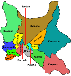 | |
| Municipalities (and seats) |
| |
This article is issued from
Wikipedia.
The text is licensed under Creative Commons - Attribution - Sharealike.
Additional terms may apply for the media files.