Quillacollo Municipality
| Quillacollo Municipality | |
|---|---|
| Municipality | |
 Quillacollo | |
 Quillacollo Municipality Location of the Quillacollo Municipality within Bolivia | |
| Coordinates: 17°15′0″S 66°20′0″W / 17.25000°S 66.33333°WCoordinates: 17°15′0″S 66°20′0″W / 17.25000°S 66.33333°W | |
| Country |
|
| Department | Cochabamba Department |
| Province | Quillacollo Province |
| Seat | Quillacollo |
| Government | |
| • Mayor | Hugo Cesar Miguel Candia (2007) |
| • President | Marcelo Galindo Gómez (2007) |
| Area | |
| • Total | 220 sq mi (560 km2) |
| Population (2001) | |
| • Total | 104,206 |
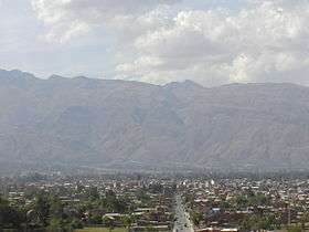
Quillacollo Municipality is the first municipal section of the Quillacollo Province in the Cochabamba Department, Bolivia. Its capital is Quillacollo. At the time of census 2001 the municipality had 104,206 inhabitants.[1]
Geography
One of the highest peaks of the municipality is Tunari at 5,023 m (16,480 ft). Other mountains are listed below:[2][3][4]
- Awila Wachana Punta
- Ichhu Apachita
- Janq'u Qala
- Jatun Kimray Punta
- Jatun Punta
- Jatun Q'asa
- Kimsa Tinkuy
- K'ayrani
- Patilla Pata
- Pirwata
- Puka Salli
- Puma Apachita
- P'utu P'utu
- Qillqata
- Qina Qina
- Qullpani Punta
- Quna Quna Q'asa
- Q'illu Suchusqa
- Salla Q'asa
- Sankayuni
- T'ula Jayani Apachita
- Uqi Salli Punta
- Urqu Punta
- Wari Warini
- Wila Qullu Punta
Subdivision
Quillacollo Municipality is divided into cantons.
| Kanton | Inhabitants (2001)[5] | Seat | Inhabitants (2001) |
|---|---|---|---|
| Quillacollo Canton | 99,276 | Quillacollo | 74,980 |
| El Paso Canton | 4,930 | El Paso | 3,344 |
See also
References
- ↑ (in Spanish) Instituto Nacional de Estadística Archived November 13, 2009, at the Wayback Machine.
- ↑ Bolivian IGM map 1:50,000 Quillacollo 6341-IV
- ↑ Bolivian IGM map 1:100,000 Quillacollo 3636
- ↑ "Quillacollo". INE, Bolivia. Archived from the original on April 9, 2016. Retrieved April 1, 2016.
- ↑ (in Spanish) Instituto Nacional de Estadística Archived November 13, 2009, at the Wayback Machine.
Capital: Cochabamba | ||
| Provinces | 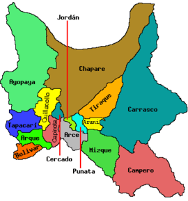 | |
| Municipalities (and seats) |
| |
This article is issued from
Wikipedia.
The text is licensed under Creative Commons - Attribution - Sharealike.
Additional terms may apply for the media files.