Tswanaland
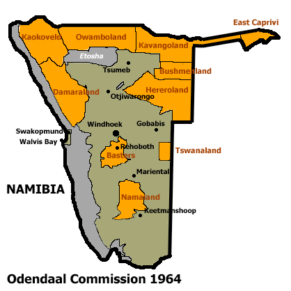
Allocation of Land to bantustans according to the Odendaal Plan. Tswanaland is the rectangle in eastern central South West Africa
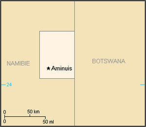
Map of the bantustan.
Tswanaland was a bantustan in South West Africa (present-day Namibia), in the far central eastern area of the territory around the village of Aminuis. It was intended by the apartheid government to be a self-governing homeland for the Tswana people. Unlike all other homelands, it was never implemented that way. The Ovaherero were allowed to stay in the area, and the Tswana remained a minority.[1] Tswanaland nevertheless got an ethnic Tswana, Constance Kgosiemang, as political leader between 1980 and 1989.[2]
Tswanaland and all other homelands in South West Africa were abolished in May 1989 at the start of the transition to independence.
See also
References
- ↑ Dierks, Klaus. "Biographies of Namibian Personalities, Entry for Clemens Kapuuo". klausdierks.com. Retrieved 14 May 2012.
- ↑ Dierks, Klaus. "Biographies of Namibian Personalities, Entry for Constance Kgosimang". klausdierks.com. Retrieved 14 May 2012.
| |||||||||||||||||||||||||||||||||||||||||||||||||||||||||||||||||||||||||||||||||||||||||||||||||||||||||||
This article is issued from
Wikipedia.
The text is licensed under Creative Commons - Attribution - Sharealike.
Additional terms may apply for the media files.