Tomar do Geru
| Tomar do Geru Município de Tomar do Geru | |||
|---|---|---|---|
| Municipality | |||
| |||
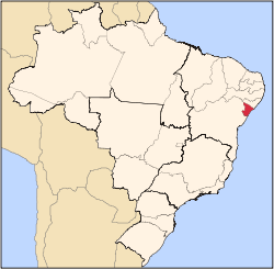
 Tomar do Geru Location of Tomar do Geru in Brazil | |||
| Coordinates: 11°22′22″S 37°50′27″W / 11.37278°S 37.84083°WCoordinates: 11°22′22″S 37°50′27″W / 11.37278°S 37.84083°W | |||
| Country |
| ||
| Region | Northeast | ||
| State |
| ||
| Founded | November 25, 1953 | ||
| Government | |||
| • Mayor | Augusto Soares Diniz | ||
| Area | |||
| • Total | 305 km2 (118 sq mi) | ||
| Elevation | 170 m (560 ft) | ||
| Population (2016) | |||
| • Total | 13,204 | ||
| • Density | 43/km2 (110/sq mi) | ||
| Demonym(s) | Geruense | ||
| Time zone | UTC-3 (BRT) | ||
| Website |
tomardogeru | ||

Tomar do Geru is a municipality located in the Brazilian state of Sergipe. Its population was 13,204 (2016) and it covers 305 km2 (118 sq mi). Tomar do Geru has a population density of 43 inhabitants per square kilometer. It is located 131 km (81 mi) from the state capital of Sergipe, Aracaju.[1] The Church of Nossa Senhora do Socorro was built by the Society of Jesus in 1688. It was listed as a historic structure by the Brazilian National Institute of Historic and Artistic Heritage (IPHAN) in 1943.[2]
References
- ↑ "Tomar do Geru" (in Portuguese). Brasília, Brazil: Instituto Brasileiro de Geografia e Estatística. 2016. Retrieved 2016-11-29.
- ↑ Dos Santos, Maria Socorro Soares (2011). A igreja Nossa Senhora do Socorro: uma escola à parte (PDF). Anais do 5º Seminário Internacional de Memória e Patrimônio (in Portuguese). Pelotas, Rio Grande do Sul: Programa de Pós-graduação em Memória Social e Patrimônio Cultural, Universidade Federal de Pelotas.
Capital: Aracaju | |||||||||||||||
| Agreste Sergipano |
|  | |||||||||||||
| Leste Sergipano |
| ||||||||||||||
| Sertao Sergipano |
| ||||||||||||||
This article is issued from
Wikipedia.
The text is licensed under Creative Commons - Attribution - Sharealike.
Additional terms may apply for the media files.