Riachuelo, Sergipe
| Riachuelo Município de Riachuelo | |||
|---|---|---|---|
| Municipality | |||
| |||
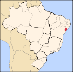
 Riachuelo Location of Riachuelo in Brazil | |||
| Coordinates: 10°43′40″S 37°11′13″W / 10.72778°S 37.18694°WCoordinates: 10°43′40″S 37°11′13″W / 10.72778°S 37.18694°W | |||
| Country |
| ||
| Region | Northeast | ||
| State |
| ||
| Founded | 1874 | ||
| Government | |||
| • Mayor | Candida Emilia Sandes Vieira Leite | ||
| Area | |||
| • Total | 78.31 km2 (30.24 sq mi) | ||
| Elevation | 37 m (121 ft) | ||
| Population (2016) | |||
| • Total | 10,116 | ||
| • Density | 130/km2 (330/sq mi) | ||
| Demonym(s) | Riachuelense | ||
| Time zone | UTC-3 (BRT) | ||
| Website |
riachuelo | ||

Riachuelo is a municipality located in the Brazilian state of Sergipe. Its population was 10,116 (2016) and covers 78.31 km2 (30.24 sq mi). Riachuelo has a population density of 130 inhabitants per square kilometer. Riachuelo is located 23 km (14 mi) from the state capital of Sergipe, Aracaju.[1] Riachuelo borders the municipalities of Laranjeiras, Divina Pastora, Santa Rosa de Lima, and Areia Branca, all within the state of Sergipe. The municipality is site of the Nossa Senhora da Penha Sugar Plantation and the Chapel of the Nossa Senhora da Penha Sugar Plantation. The chapel was listed as a historic structure by National Institute of Historic and Artistic Heritage (IPHAN) in 1943, but has fallen into an advanced state of neglect and decay and is considered abandoned.[2]
References
- ↑ "Riachuelo" (in Portuguese). Brasília, Brazil: Instituto Brasileiro de Geografia e Estatística. 2017. Retrieved 2017-01-25.
- ↑ "Engenho Nossa Senhora da Penha: capela (Riachuelo, SE)" (in Portuguese). Brasília: Instituto do Patrimônio Histórico e Artístico Nacional. Retrieved 2017-01-05.
Capital: Aracaju | |||||||||||||||
| Agreste Sergipano |
|  | |||||||||||||
| Leste Sergipano |
| ||||||||||||||
| Sertao Sergipano |
| ||||||||||||||