Laranjeiras, Sergipe
| Laranjeiras Município de Laranjeiras | |||
|---|---|---|---|
| Municipality | |||
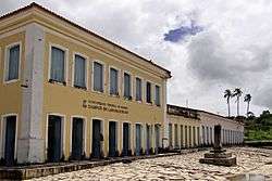 Historic street along Universidade Federal de Sergipe, Laranjeiras Campus | |||
| |||
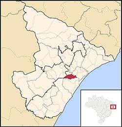 Location of Laranjeiras in Sergipe | |||
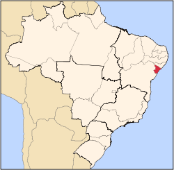
 Laranjeiras Location of Laranjeiras in Brazil | |||
| Coordinates: 10°48′21″S 37°10′12″W / 10.80583°S 37.17000°WCoordinates: 10°48′21″S 37°10′12″W / 10.80583°S 37.17000°W | |||
| Country |
| ||
| Region | Northeast | ||
| State |
| ||
| Founded | August 7, 1832 | ||
| Government | |||
| • Mayor | Jose de Araujo Leite Neto | ||
| Area | |||
| • Total | 162.27 km2 (62.65 sq mi) | ||
| Elevation | 9 m (30 ft) | ||
| Population (2016) | |||
| • Total | 29,418 | ||
| • Density | 180/km2 (470/sq mi) | ||
| Demonym(s) | Laranjeirense | ||
| Time zone | UTC-3 (BRT) | ||
| Website |
laranjeiras | ||


Laranjeiras (English: Orange trees) is a municipality located in the Brazilian state of Sergipe. Its population was 29,418 (2016) and covers 162.27 km2 (62.65 sq mi). Laranjeiras has a population density of 180 inhabitants per square kilometer. Laranjeiras is located 19 km (12 mi) from the state capital of Sergipe, Aracaju.[1] It borders the municipalities of Riachuelo, Areia Branca, Nossa Senhora do Socorro, São Cristóvão, Maruim, and Santo Amaro das Brotas, all within the state of Sergipe. The municipality contains part of the Serra de Itabaiana National Park.[2]
References
- ↑ "Laranjeiras" (in Portuguese). Brasília, Brazil: Instituto Brasileiro de Geografia e Estatística. 2016. Retrieved 2016-11-21.
- ↑ Unidade de Conservação: Parque Nacional da Serra de Itabaiana (in Portuguese), MMA: Ministério do Meio Ambiente, retrieved 2016-05-03
Capital: Aracaju | |||||||||||||||
| Agreste Sergipano |
|  | |||||||||||||
| Leste Sergipano |
| ||||||||||||||
| Sertao Sergipano |
| ||||||||||||||
This article is issued from
Wikipedia.
The text is licensed under Creative Commons - Attribution - Sharealike.
Additional terms may apply for the media files.