Tolna, Hungary
| Tolna Alta Ripa (in Latin) Tolnau (in German) | ||
|---|---|---|
| Town | ||
| ||
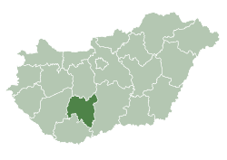
 Tolna Location of Tolna, Hungary | ||
| Coordinates: 46°25′25″N 18°47′25″E / 46.42363°N 18.79025°ECoordinates: 46°25′25″N 18°47′25″E / 46.42363°N 18.79025°E | ||
| Country |
| |
| County | Tolna | |
| District | Tolna (district) | |
| Area | ||
| • Total | 71.08 km2 (27.44 sq mi) | |
| Population (2010) | ||
| • Total | 11,518 | |
| • Density | 162.04/km2 (419.7/sq mi) | |
| Time zone | UTC+1 (CET) | |
| • Summer (DST) | UTC+2 (CEST) | |
| Postal code | 7130 | |
| Area code | (+36) 74 | |
| Website |
www | |

Tolna (German: Tolnau) is a town in Tolna county, Hungary. It lies about 10 kilometres (6 miles) north of Szekszárd and 135 kilometres (84 miles) south of Budapest.
Twin towns — sister cities
Tolna is twinned with:
External links
| Wikimedia Commons has media related to Tolna. |
- Official website in Hungarian
| Town (1) |
| |
|---|---|---|
| Large village (1) | ||
| Villages (2) | ||
| City with county rights |
|   |
|---|---|---|
| Towns | ||
| Large villages | ||
| Villages |
| |
| Other topics |
| |
This article is issued from
Wikipedia.
The text is licensed under Creative Commons - Attribution - Sharealike.
Additional terms may apply for the media files.