Tjeldsundet
| Tjeldsundet | |
|---|---|
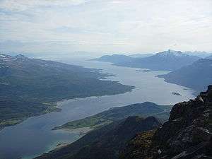 View of Tjeldsundet seen from Sætertind looking south | |
 Tjeldsundet Location of the fjord  Tjeldsundet Tjeldsundet (Nordland)  Tjeldsundet Tjeldsundet (Norway) | |
| Location | Troms county, Norway |
| Coordinates | 68°35′28″N 16°32′01″E / 68.5910°N 16.5336°ECoordinates: 68°35′28″N 16°32′01″E / 68.5910°N 16.5336°E |
| Type | Fjord |
| Basin countries | Norway |
| Max. length | 50 kilometres (31 mi) |
Tjeldsundet is a strait in Northern Norway. The 50-kilometre (27 nmi; 31 mi) long strait is located between the island of Hinnøya and mainland Norway in its northern part and between Hinnøya and the island of Tjeldøya in its southern part. Tjeldsundet has been an important waterway for more than 1,000 years and was well known and used during the Viking Age.
The northern part is in Troms county between the municipalities of Harstad and Skånland, while the southern part is located in Nordland county between the municipalities of Tjeldsund and Lødingen. The southern entrance to the strait begins at the Ofotfjorden at the village of Lødingen and the town of Harstad is located at the northern entrance of the strait where it empties into the Vågsfjorden.
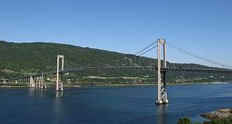
The Tjeldsund Bridge connects Hinnøya to the mainland by the E10 road, also known as King Olav's Road (Norwegian: Kong Olavs vei), part of which goes from the town of Harstad to Harstad/Narvik Airport, Evenes.[1]
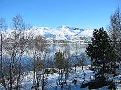
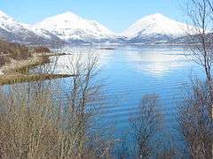
Media gallery
.jpg)
References
- ↑ Store norske leksikon. "Tjeldsundet" (in Norwegian). Retrieved 2010-04-04.
External links
