Tiszaeszlár
| Tiszaeszlár | ||
|---|---|---|
| ||
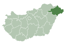
 Tiszaeszlár Location of Tiszaeszlár in Hungary | ||
| Coordinates: 48°03′N 21°28′E / 48.05°N 21.47°ECoordinates: 48°03′N 21°28′E / 48.05°N 21.47°E | ||
| Country | Hungary | |
| Region | Northern Great Plain | |
| County | Szabolcs-Szatmár-Bereg | |
| Area[1] | ||
| • Total | 54.56 km2 (21.07 sq mi) | |
| Population (2012)[2] | ||
| • Total | 2,566 | |
| • Density | 47/km2 (120/sq mi) | |
| Time zone | UTC+1 (CET) | |
| • Summer (DST) | UTC+2 (CEST) | |
| Postal code | 4464 | |
| Area code | +36 42 | |
| Website |
www | |

Tiszaeszlár (Old form: Tisza-Eszlár) is a village in Szabolcs-Szatmár-Bereg, Hungary.
References
- ↑ Tiszaeszlár at the Hungarian Central Statistical Office (Hungarian).
- ↑ Tiszaeszlár at the Hungarian Central Statistical Office (Hungarian). 2012
See also

This article is issued from
Wikipedia.
The text is licensed under Creative Commons - Attribution - Sharealike.
Additional terms may apply for the media files.